June 2003
Writing a river's history | |
|  | | River Trent : Trent Bridge |
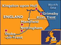
| | The River Trent snakes through the East Midlands for 280km, starting in Staffordshire and ending in north Lincolnshire.
Brady Haran reports |
| | | Many of its benefits are clear - it provides water, natural beauty and its valley is a rich source of gravel.
Other treasures are not so evident, often buried beneath metres of soil.
But for those who know what they are looking for, those treasures can be the most fascinating.
They tell a story of the Trent Valley spanning thousands of years - epic tales of climate change, landscape formation and early human settlement.
That information is now being researched and collated thanks to funding from an unusual source - the gravel industry.
Project co-ordinator Mike Bishop says the valley is "dense with archaeological remains", including prehistoric ritual monuments and Roman settlements.
However in many cases these remains are only visible by studying so-called "crop marks", usually seen from the air.
These marks are tell-tale signs caused when crop growth is affected by differences in soil depth.
For example, deeper soil caused by an ancient ditch increases nutrients and moisture, making a crop ripen earlier.
Mr Bishop says: "Ultimately the true story lies in the soil and awaits a spade."
The Trent Valley GeoArchaeology project brings together many councils, trusts and universities which have an interest in the region.
Along with charting crop marks, the project's various schemes include: - Mapping ancient river channels.
- Producing maps about archaeological sites.
- Adding to the Trent Valley Sites and Monuments Record maintained by local authorities.
In essence, it is pulling together a definitive source of information about the river valley.
A key use of the information will include helping planners decide where future gravel pits can be located.
Mr Bishop also hopes the information will be the foundation for future archaeological studies. "This resource is part of our wider heritage, but it is vulnerable to development."
"The most important features must be protected so that future generations can study it with improved techniques."
Mr Bishop said while all rivers had unique aspects, the Trent was particularly interesting for several reasons.
These include its "dynamic nature", which is unlike many other English rivers in terms of hydrology and geomorphology.
It also lies in a key geographical position between the highland and lowland zones and between England's north and south. | | | |
|
|