
A taste of spring... albeit with a chilly breeze!
Much of this week has brought some quite glorious weather for our region and there's more to come into the weekend and beyond.
With a sizeable area of high pressure locked - for now at least - in-situ to the NW of the British Isles, the prospect of any precipitation here in the West Country remains firmly surpressed for quite a number of days ahead. The settled conditions will allow some very muddy lawns, footpaths and parks a chance to dry out somewhat!
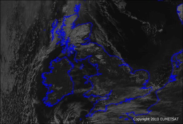
Albeit cloud cover will tend to come and go, there'll be plenty of March sunshine on offer over the coming days and indeed today's readily-clearing weather has been wonderfully picked-out in a pass by the METOP satellite at a fairly low level orbit this morning - as shown below in an image taken at 10.19am (photo courtesy of EUMETSAT).
 If you've been out and about, you'll have noticed the keen, chilly and rather gusty breeze blowing from the E/NE and this will remain a (rather unwelcome, for most folk!) feature of our weather into next week, too. Nonethless, as I emphasised in our TV and radio forecasts this morning, if you find somewhere sheltered from the breeze and soak-up the early March sunshine, it'll feel distinctly springlike!
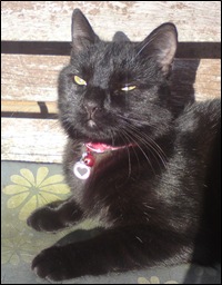 My cats certainly agree... they're currently sprawled over parts of the back garden, basking like a pride of lions (the youngest is shown, right - it's her first-ever spring).
The snow threat is gone for the West Country and potentially it's vanished now until next winter. On current reckoning - albeit with many uncertainties at present - the Met Office predicts the dry, settled but chilly weather to prevail until the following weekend (13/14th).
A change to more unsettled cyclonic conditions is likely at some stage around the 15-17th. As this occurs, a westerly influence is expected to take over - thus returning temperatures to the average for this time of year. So, as we eventually lose the current cold easterly flow, hopefully the long, noteworthy winter of 2009-2010 finally takes a bow... at least for southern parts of the British Isles.
 I'm Ian Fergusson, a BBC Weather Presenter based in the West Country. From benign anticyclones to raging supercell storms, my blog discusses all manner of weather-related issues. I also provide updated race weekend forecasts tied to our BBC coverage of Formula One. You can follow me on
Comment number 1.
At 20:33 4th Mar 2010, BristleSi wrote:Thanks for the update Ian.
I really don't want the unsettled change to come in during the week you mention as it'll mess up my Cheltenham bets!
Plus myself and my darling wife are off to dartmouth for a few days in the 2nd half of that week. Here's hoping the wet weather holds off until w/c 22nd.
Complain about this comment (Comment number 1)
Comment number 2.
At 13:18 6th Mar 2010, Jack Mason wrote:Hi Ian,
Im loving this settled spell of weather (thank god for high pressure systems!) but when do you think we will see some warmer weather with this sunshine?!
Jack
Complain about this comment (Comment number 2)
Comment number 3.
At 11:23 7th Mar 2010, Swindon Queso wrote:Loving this weather, especially the clarity of the light but keep going out without my hat and getting very cold ears.
Complain about this comment (Comment number 3)
Comment number 4.
At 15:28 17th Mar 2010, basketmaker_dave wrote:Spring has really sprung. my temp reading outside my back yard which lies in permenent shade is +17.2in stoke st gregory, unofficial of course. this with mostly cloudy conditions. basketmaker dave
Complain about this comment (Comment number 4)