
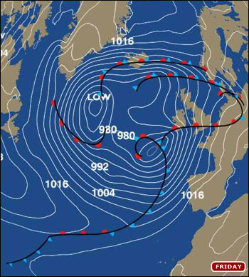
A spectacular spiral of storms...
I've just endured a nightmarish drive along the M4 from Bristol to Reading and back again.
It was a journey punctuated by two extremes of weather: passing beneath ink-black skies and torrential downpours for a few miles; then suddenly emerging into calm spells of blue sky and sunshine, only to see the next crop of ominously dark clouds looming-up a few miles further ahead.
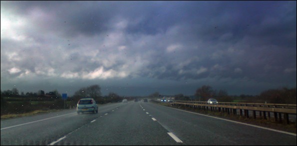
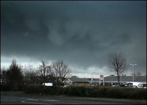
Another line of dark Cumulonimbus clouds loom on the M4 passing through Wiltshire (Photo: Doug Fergusson)
The return journey to Bristol was quite simply treacherous. Beneath vast walls of towering Cumulonimbus clouds, the M4 through Wiltshire seemed as if gripped by the darkness of night. Long stretches of standing water routinely flicked the steering wheel through my grasp as the risk of aquaplaning became ever prevalent. A nasty-looking accident I passed at the A46 junction for Bath seemed to prove the point: these were truly perilous conditions on the motorway.
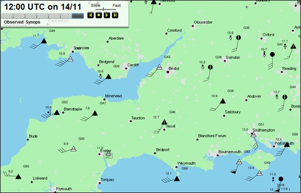
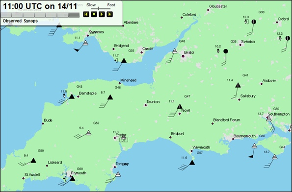
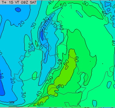
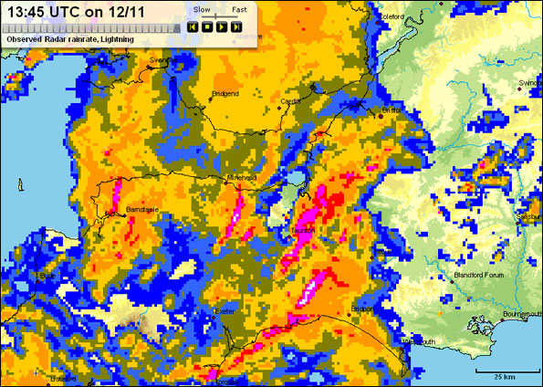
As the spectacular rainfall radar image below shows, we've been subjected to a spiral of heavy showers and thunderstorms today, all circulating around a low pressure centre passing northeastwards across the Westcountry. It's the rotating lines of heavy showers - so visible here - that created the on-off nature of wet versus dry weather I passed through along the M4.
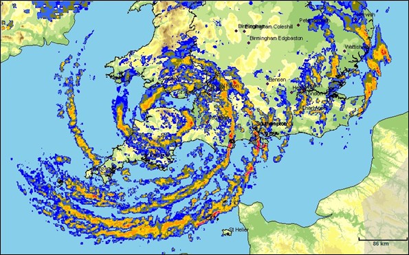
Met Office rainfall radar at 1030hrs on Sunday, November 29th 2009, clearly shows spectacular clusters of heavy showers spiralling around a centre of low pressure as it crosses Exmoor, moving east-northeast (Image: via Met Office MBS system)
Around the main vortex of this low, the winds are tending to blow readily in different directions and speeds at low levels in the atmosphere.
This wind shear, or shear vorticity, could well create funnel clouds to form in a few spots today. I noticed some impressive-looking lowering of the cloud base in some areas along the M4 corridor, but no obvious funnels. But then a detailed stormspotting effort is hardly easy - nor wise - when trying to avoid aquaplaning into the roadside scenery near Lyneham!

 There's all manner of editorial decisions to be made by
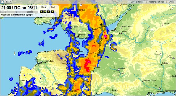
 I'm Ian Fergusson, a BBC Weather Presenter based in the West Country. From benign anticyclones to raging supercell storms, my blog discusses all manner of weather-related issues. I also provide updated race weekend forecasts tied to our BBC coverage of Formula One. You can follow me on