
There was some dramatic weather last weekend with torrential rain and thunderstorms on Saturday.
Steve Jones took this photo of fork lightning over the Bristol Channel near Porthcawl.
And how about this one by Johnny Cane; looks like a direct hit to me!
A bolt of lightning can travel at up to 136,000mph and reach temperatures of 30,000°C - five times hotter than the surface of the sun!
The sound of thunder is made by lightning heating the air around it. The air expands very rapidly and causes sound waves.
For more thunder and lightning facts see one of my previous blog posts, and find out how thunderstorms form on the Met Office website.
There were sunny spells as well and it was warm with a high of 22.4°C in Hawarden, Flintshire on Sunday afternoon. RAF Valley on Anglesey recorded 11 hours of sunshine yesterday.
This was the view from Great Orme, Llandudno yesterday by Dewi Eirig Jones.
Looking ahead, low pressure and troughs will bring more showers tonight and tomorrow, the showers will be heavy in places with thunder.
However, during Wednesday high pressure will begin to take over settling the weather down. Sunny spells are likely on Thursday and Friday and it will become warmer too.
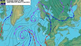
Forecast chart: Wednesday 11 June
Next weekend, it looks like the high pressure will move and change its position and the wind will turn more into the north and northeast. This means temperatures may drop a bit, we may also see a few showers on Saturday but on the whole plenty of dry weather seems likely.
