
A major winter storm affecting northeast America is not heading our way but the UK is going to turn much colder from midweek with Arctic winds bringing frequent wintry showers.
Scotland, Northern Ireland and northern England look like seeing the worst of the snow and a Met Office yellow warning of severe weather has been issued.
Parts of Wales will have some snow too but amounts will vary from place to place. On windward coasts rain or sleet is likely with accumulations of snow on higher ground such as Snowdonia and the hills of Powys and Carmarthenshire.
The cold air will become very unstable as it crosses the sea with towering clouds bringing a risk of hail and thunder.
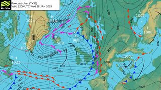
Met Office forecast chart for Wednesday 28 January
Even if you don’t get much snow, the wind will be a big feature, strong to gale force for many, with a significant wind chill and temporary blizzard conditions over high ground.
Friday is likely to be slightly less cold, with a wintry mix of rain, sleet and hail showers with snow on higher ground. Much colder air is expected to return over the weekend – possibly the coldest air of the winter so far!
Sunny spells and further wintry showers are expected, with a north to north-westerly wind. Parts of west Wales will be at risk of snow with a line of heavy showers moving in from the Irish Sea.
It looks like the cold spell will continue well into next week. The wind should ease with time, allowing some low night time temperatures, especially over any snow cover and hard frosts.
