
It’s been a shock to the system over the weekend after a fairly mild start to November; we've had a very cold and frosty couple of nights. The cold snap is pretty short lived as the weather is set to become milder through this week.
Over the weekend we had a few snow showers especially on higher ground.
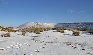
Brecon Beacons by Mike Davies
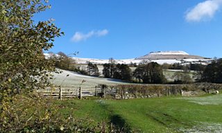
Table Mountain by Fay Clubb
The cold weather is set to continue for a time through Monday, but at least it's sunny. A weather front will change the dynamics of our weather as we go into Monday night. This front will bring some rain and wind from the north-west. It will also bring an Atlantic airflow, so it will be a little bit milder into early hours of Tuesday morning.
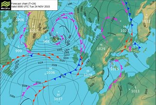
Pressure chart for Tuesday 24 November
Tuesday morning should be frost free thanks to the breeze. However it looks to be a day of blustery showers with some brightness and temperatures ranging between 8-10°C.
The blustery showers continue into Wednesday with limited amounts of brightness. Thursday looks dry but cloudy with a very mild night to follow. We can expect more wind and rain on the agenda on Friday.
So there’s bit of everything in the forecast this week to keep us talking about our wonderful Welsh weather!
