
June started on a stormy note but it was short lived. We can now relax and enjoy the fine weather.
By no means are we going to have a heatwave, but conditions are good enough to get out and about.
The image from space today shows barely a cloud in the sky. Perhaps some high level cloud will come into Pembrokeshire later on, which will make the sunshine hazy. The UV levels are high, so do take sunscreen with you if you are going to be out and about. Temperatures today are reaching a high of 20°C.
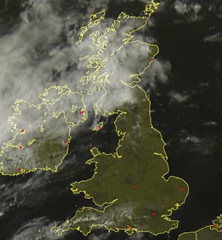
Satellite image for Thursday 4 June
The pressure chart shows high pressure controlling our weather from the near continent. An area of low pressure and a cold front will bring thicker cloud and a spell of rain to west Wales tomorrow. By mid-to-late afternoon that will clear eastwards. By the time most people finish work on Friday it should be a nice and sunny end to the day, but it will feel fresher.
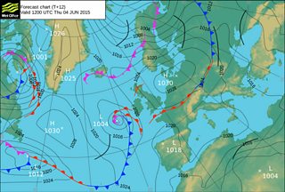
Weather chart for Thursday 4 June
The weekend will be dry and sunny, but it will be a little bit windy on Saturday. Sunday will be dry and bright with lighter winds. Perfect conditions to have a barbecue!
High pressure will continue to control our weather next week to bring more fine weather. If you are out and about please take some pictures and share them with us. Here is one that was sent via Twitter.

Langland Bay Golf Club by Ian Phillips
