Coastal map skills
Using aerial photographs
Aerial photos can be used to help identify coastal features. There are a number of coastal features that can be identified on aerial photos or Ordnance Survey maps.
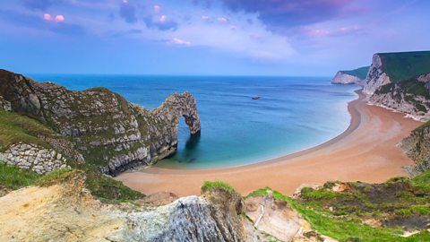
It is usually easy to understand the differences between cliffs (erosion landforms) and beaches (deposition landforms). The most obvious coastal feature is the long depositional finger of land that makes up a hooked A long, narrow ridge of land that is formed due to deposited material along a coastline..
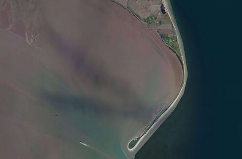
This satellite image shows the development of a Hooked Spit on the Holderness area on the east coast of England. The wearing away of pieces of rock, soil or other solid materials. around the village of Withernsea is then transported down the coastline through the process of When eroded material in the sea is carried along the beach in a zig zag course..
The spit starts to form where the coastline changes direction. The velocity of the water from the River Humber and power of the sea will meet at a certain place where a long hooked beach will form.
Using OS maps to identify coastal features
Tourists often use OS maps to help them to identify quiet, secluded pieces of the coastline where they can enjoy a nice sandy beach in relative solitude.
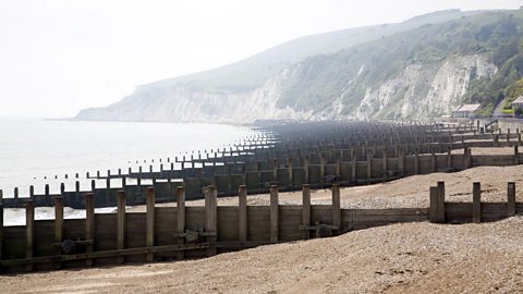
Maps will often show the key erosion and This takes place when the sea loses energy, it drops (or deposited) the sand, rock particles and pebbles it has been carrying. features studied at GCSE geography. In addition, some places will also show evidence of coastal management, Wooden, concrete or rock barriers that are built at 90 degrees to the coastline so that they will trap sand carried along the shore by longshore drift. and A solid wall that is used to separate the land from the sea. Often these are shaped to reflect wave energy back into the sea..
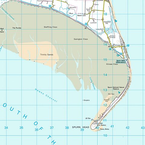
The Ordnance Survey map of the Holderness coastline helps to reinforce the idea that Spits like Spurn Head can often be temporary structures that are only one storm away from removal.
The build-up of sand at 421 140 has been removed to the point that the end of the spit has nearly been left as an island. This deposition beach is in a constant state of flux and even though the end of the spit has a Life Boat station (397 111) and a Pilot Station (400 109) – access to these could be jeopardised at times.
For more general revision of map skills go to the Map skills section in Geographical skills
Watch: Coastline management strategies
Coastline management strategies using hard and soft engineering.
Activity: Take the test

More on Coastal environments
Find out more by working through a topic
- count4 of 4
- count1 of 4

- count2 of 4