The importance of maps
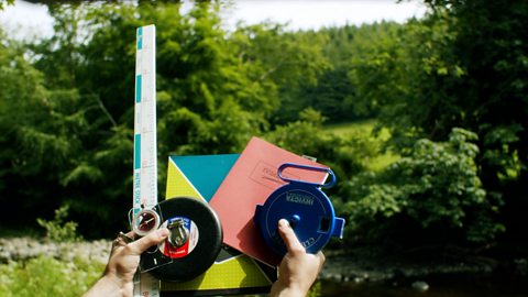
Field trips allow students of geography to put their skills to the test, connecting everything that they have learned in the classroom with the real world.
For centuries, maps were drawn by hand, but today most printed maps are made using computer programs.
Maps are so key to our lives, to how we move from place to place. But how would you go about defining what a map actually is?
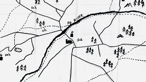
Maps have symbols - drawings of actual landscapes and features that use lines and shapes to represent real-life objects like forests, motorways and the coastline. Maps can also be artistic and imaginative, such as sketch maps or maps made out of leaves or they can be very detailed and accurate like the Ordnance Survey maps of Northern Ireland.
Maps use symbols for many reasons. The main one is that maps have to label and show many things, such as picnic sites or a bus station, so people can locate where they are.
Ordnance Survey maps can’t have every single thing labelled because there would be too much writing and it would not be very clear. To get around this problem, cartographers - the people who make the maps - use different shapes, lines, colours and symbols to show the things that define our local environment and landscape.
Map skills
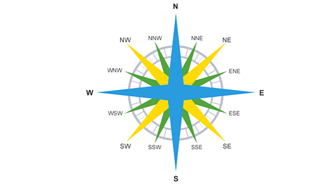
When you are out and about doing your fieldwork, it is important that you know how to read and use a map. Understanding where north, east, south and west are, is key to map reading. Here is an easy way of remembering the points of the compass: Never Eat Shredded Wheat. Most typical maps are always printed so that north is at the top of the sheet.
If you look at an Ordnance Survey map, you can see that it has a series of blue grid lines. The lines help you to identify an exact location anywhere on the map by giving a unique number known as a grid reference.

Finding a four-figure grid reference
A grid of squares helps the map-reader to locate a place. The vertical lines are called eastings. They are numbered - the numbers increase to the east. The horizontal lines are called northings as the numbers increase in an northerly direction.
Things to remember:When you give a grid reference, always give the easting first: "Along the corridor and up the stairs".
- Start at the left-hand side of the map and go east until you get to the bottom-left-hand corner of the square you want. Write this number down.
- Move north until you get to the bottom-left corner of the square you want. Look at the number of this grid line and add it to the two-digit number you already have. This is your four-figure grid reference.
Finding a six-figure grid reference
Sometimes it is necessary to be even more accurate. In this case you can imagine that each grid is divided into 100 tiny squares. The distance between one grid line and the next is divided into tenths.
- First, find the four-figure grid reference but leave a space after the first two digits.
- Estimate or measure how many tenths across the grid square your symbol lies. Write this number after the first two digits.
- Next, estimate how many tenths up the grid square your symbol lies. Write this number after the last two digits.
- You now have a six figure grid reference. In this instance, the tourist information office is located at 476334.
Scale
To read a map, you must understand how scale works. Scale shows how much you would have to enlarge your map to get the actual size of the piece of land you are looking at.
Let’s work through an example to understand this concept: if a map has a scale of 1:18000, it means that every 1 cm on the map represents 18,000 of those same units of measurement on the ground. Although this sounds complicated, most maps have been made to make understanding scale straightforward.
For example, if you look at a map of the North Coast, it might have a 1:18,000 scale and you might see that the scale has been written out as 3 cm to 1km. This means that every 3 cm on a map equals 1km on the ground. Even easier, cartographers have designed Ordnance Survey maps so that the gridlines match the scale. To continue with our example, the gridlines are exactly 3 cm apart, so every square is 1 km by 1 km.
More on Field Work
Find out more by working through a topic
- count1 of 3
- count2 of 3