Cartoon Maps - Politics and Satire
The series concludes by delving into the world of satirical maps. How did maps take on a new form as devices for humour, satire or storytelling?
The series concludes by delving into the world of satirical maps. How did maps take on a new form, not as geographical tools, but as devices for humour, satire or storytelling?
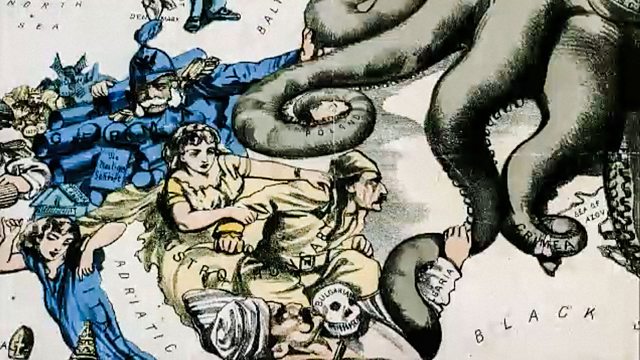
Graphic artist Fred Rose perfectly captured the public mood in 1880 with his general election maps featuring Gladstone and Disraeli, using the maps to comment upon crucial election issues still familiar to us today. Technology was on the satirist's side, with the advent of high-speed printing allowing for larger runs at lower cost. In 1877, when Rose produced his Serio Comic Map of Europe at War, maps began to take on a new direction and form, reflecting a changing world.
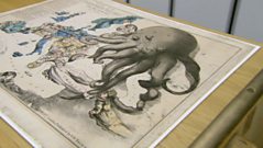
Rose's map exploited these possibilities to the full using a combination of creatures and human figures to represent each European nation. The personification of Russia as a grotesque-looking octopus, extending its tentacles around the surrounding nations, perfectly symbolised the threat the country posed to its neighbours.
Last on
More episodes
Previous
Next
You are at the last episode
Clips
![]()
Satire Maps and Fred W Rose
Duration: 03:31
![]()
Legacy of the Satire Map
Duration: 04:03

Music Played
![]()
Camille Saint‐Saëns
Carnival of the Animals: The Aquarium

Credits
| Role | Contributor |
|---|---|
| Director | Steven Clarke |
| Producer | Steven Clarke |
| Executive Producer | Harry Bell |
Broadcasts
 Thu 22 Apr 201020:30
- Fri 23 Apr 201000:25
 Fri 23 Apr 201001:30BBC HD
- Fri 30 Apr 201019:00BBC HD
- Sun 2 May 201019:30
- Fri 22 Oct 201020:00BBC HD
- Sun 24 Oct 201019:30
- Tue 1 Feb 201119:30
- Wed 2 Feb 201101:00
- Tue 31 May 201100:30BBC HD
- Wed 1 Jun 201101:30BBC HD
- Fri 3 Jun 201100:20BBC HD
- Wed 13 Jul 201119:30
- Thu 11 Aug 201123:00BBC HD
- Mon 15 Aug 201122:30BBC HD
- Thu 23 Apr 202019:30
- Fri 11 Sep 202000:45
- Wed 20 Oct 202100:25
- Mon 11 Apr 202200:45
