The Friday night rush
How far can you get in an hour?
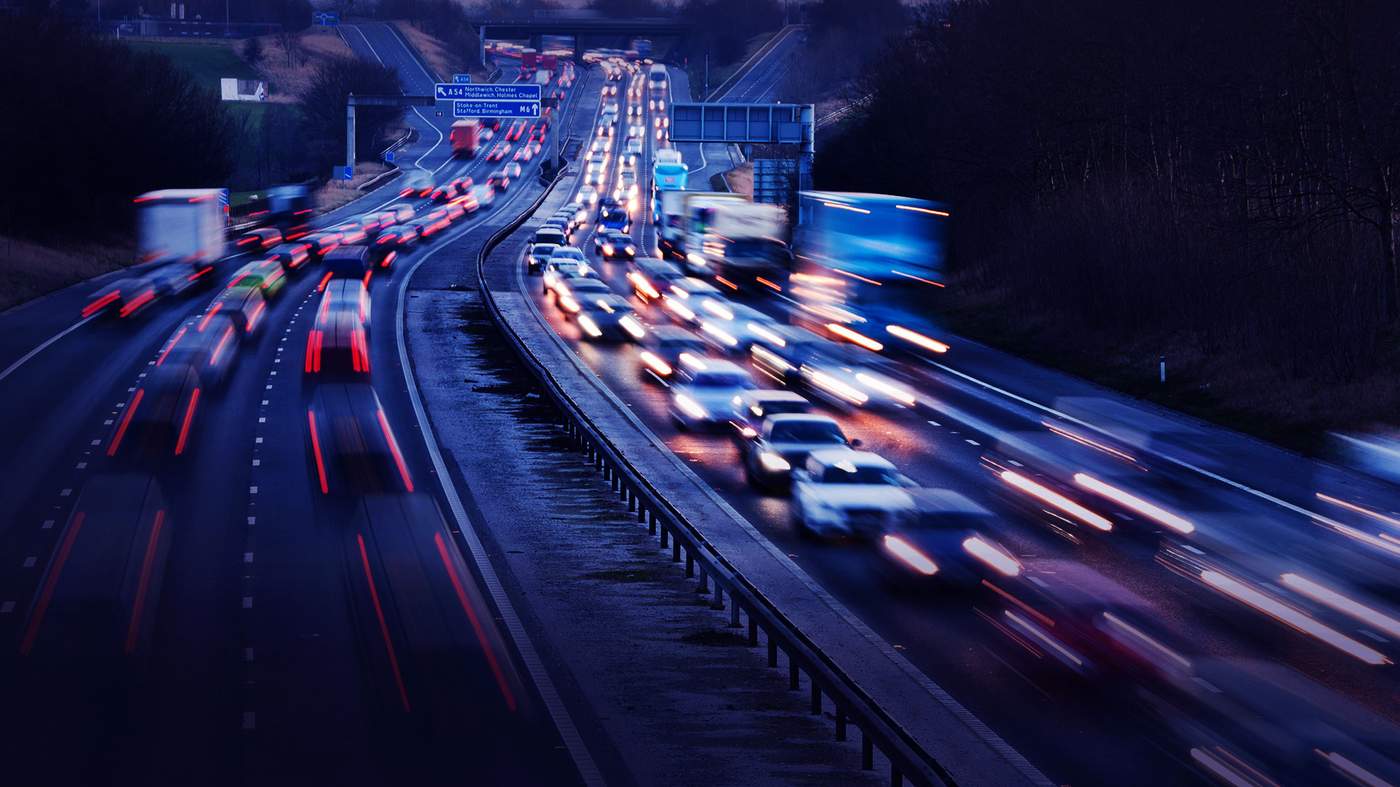


Traffic jams on a Friday afternoon always seem to be the worst of the working week - as daily commuters are joined by those heading for a weekend getaway.
But how far can motorists get in an hour on a typical Friday?
And does leaving later - to avoid the worst queues - make that much of a difference?
Take a scroll through these maps -created by mapping and analytics software company Esri UK - which show driving distances from 10 of the busiest city centres.

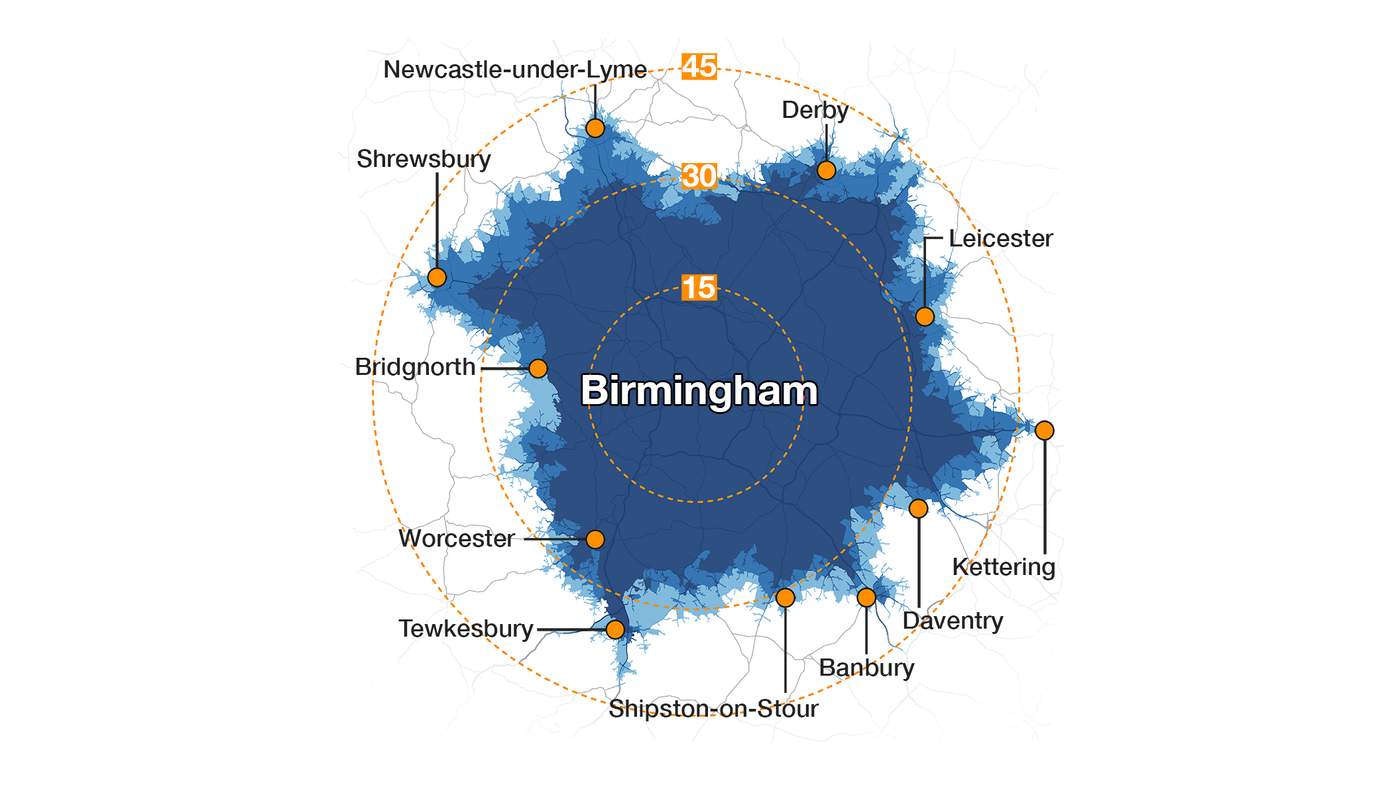
Birmingham
Start point: New Street Station
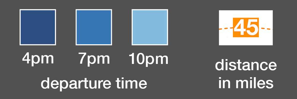
Map shows the furthest that can be travelled by road in 60 minutes on a typical Friday - if you leave at the following times:
Maximum possible distances
4pm = 45.1 miles
7pm = 48.9 miles
10pm = 49.7 miles

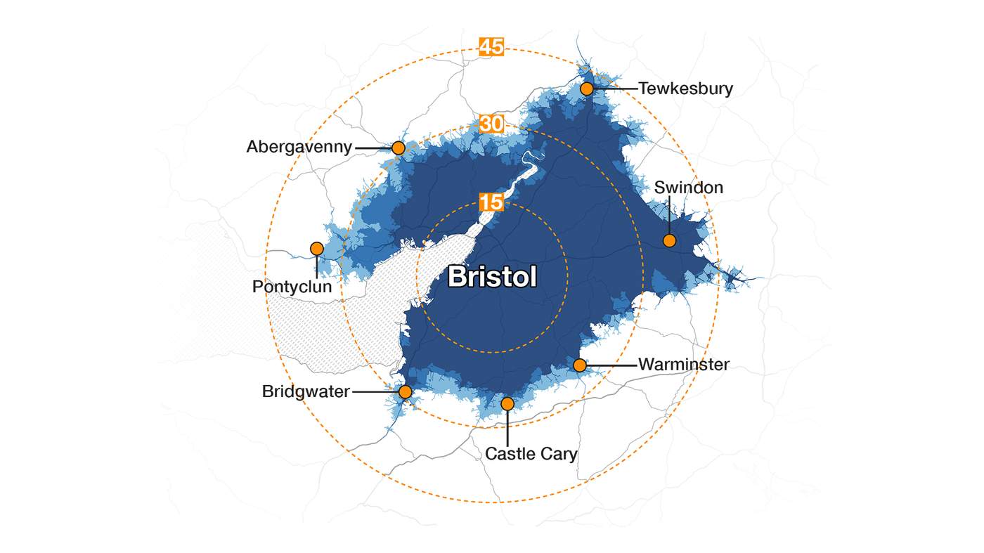
Bristol
Start point: Bristol Shopping Quarter
Bristol is the best of these 10 cities for journey distances in the 4pm rush hour.
Map shows the furthest that can be travelled by road in 60 minutes on a typical Friday - if you leave at the following times:
Maximum possible distances
4pm = 52.2 miles
7pm = 52.4 miles
10pm = 54.1 miles

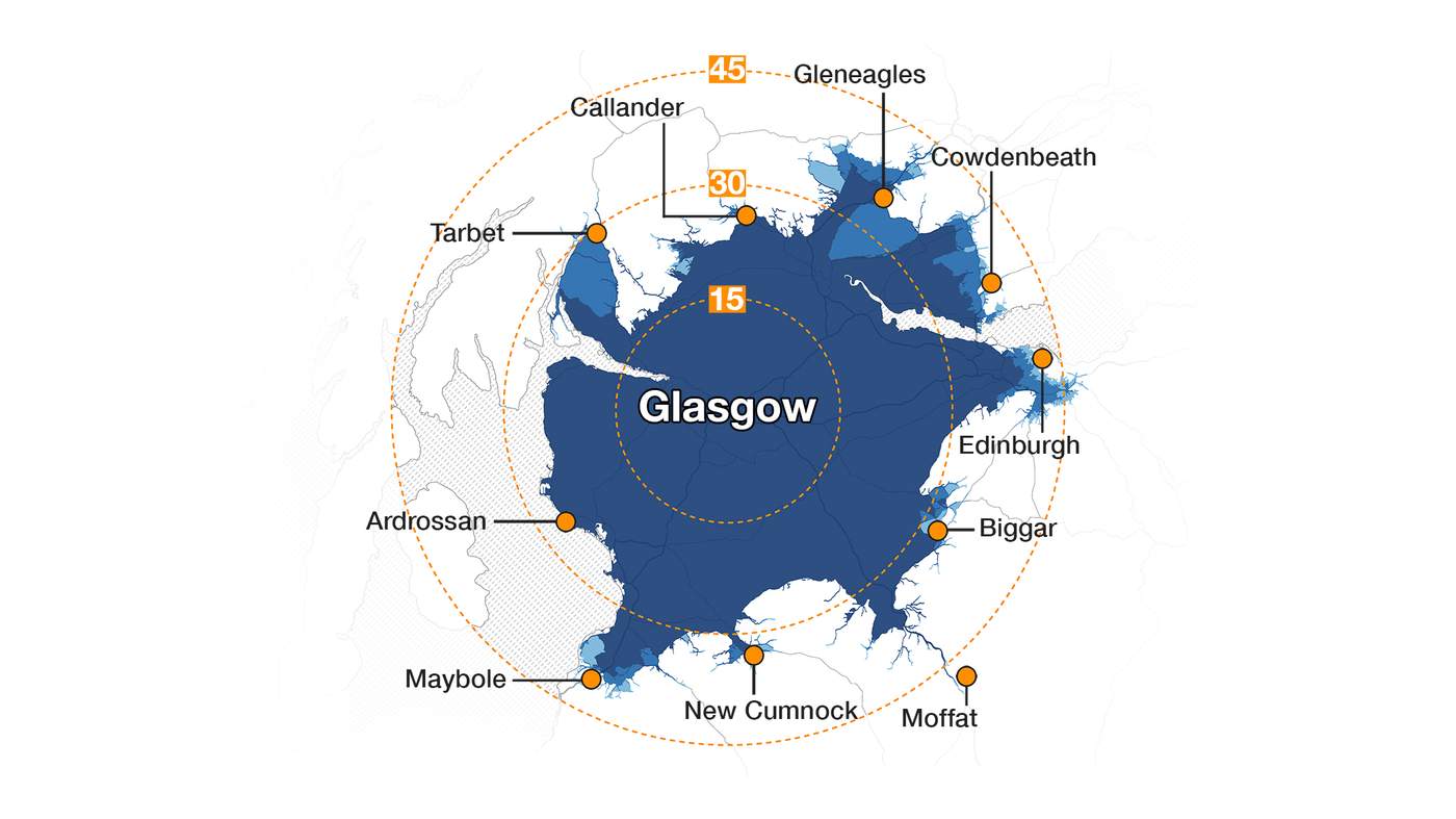
Glasgow
Start point: Glasgow Central Station
Map shows the furthest that can be travelled by road in 60 minutes on a typical Friday - if you leave at the following times:
Maximum possible distances
4pm = 46.9 miles
7pm = 48.1 miles
10pm = 49.6 miles

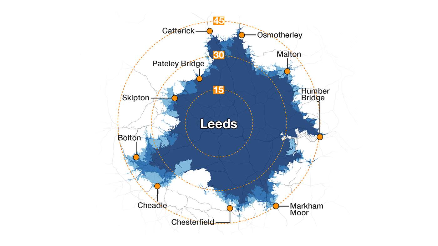
Leeds
Start point: Trinity Leeds
Map shows the furthest that can be travelled by road in 60 minutes on a typical Friday - if you leave at the following times:
Maximum possible distances
4pm = 47.9 miles
7pm = 48.5 miles
10pm = 48.5 miles

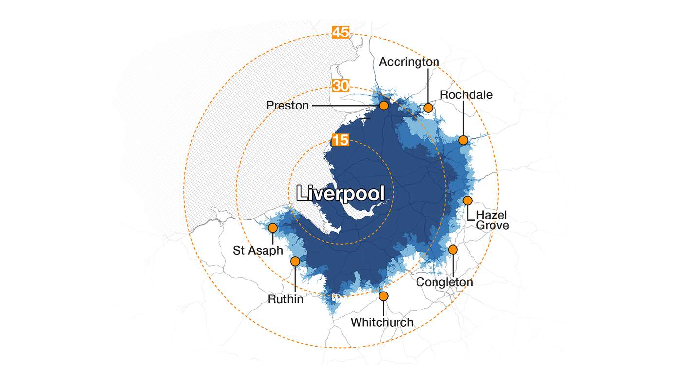
Liverpool
Start point: Liverpool Central Station
Map shows the furthest that can be travelled by road in 60 minutes on a typical Friday - if you leave at the following times:
Maximum possible distances
4pm = 34.0 miles
7pm = 41.6 miles
10pm = 45.6 miles

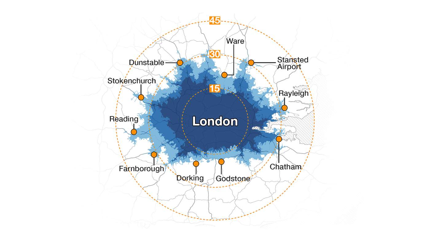
London
Start point: Charing Cross Station
London is the worst of these 10 cities for journey distances in the 4pm rush hour.
Map shows the furthest that can be travelled by road in 60 minutes on a typical Friday - if you leave at the following times:
Maximum possible distances
4pm = 31.8 miles
7pm = 36.3 miles
10pm = 42.4 miles
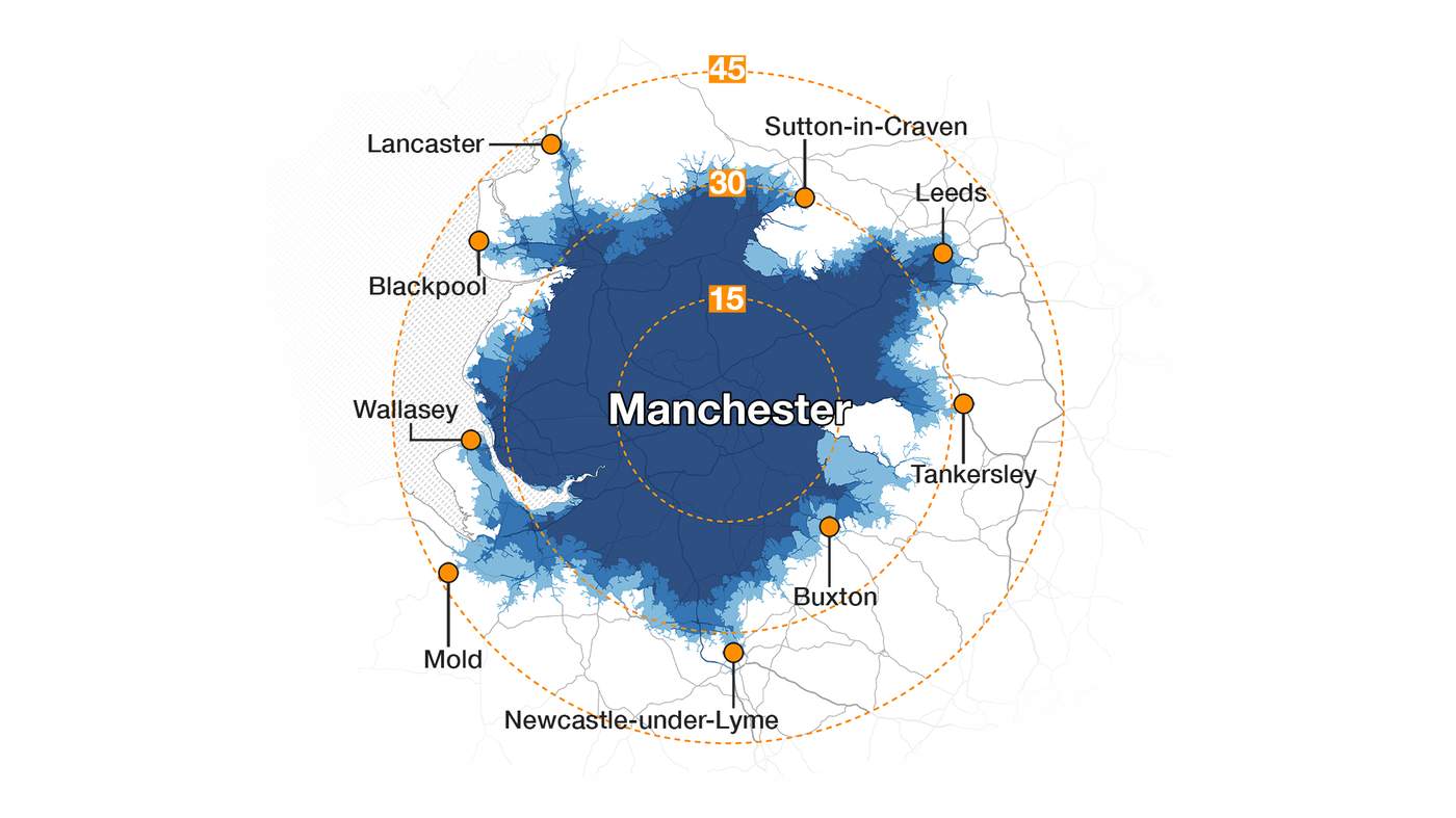
Manchester
Start point: Manchester Arndale
Map shows the furthest that can be travelled by road in 60 minutes on a typical Friday - if you leave at the following times:
Maximum possible distances
4pm = 39.3 miles
7pm = 42.4 miles
10pm = 44.8 miles

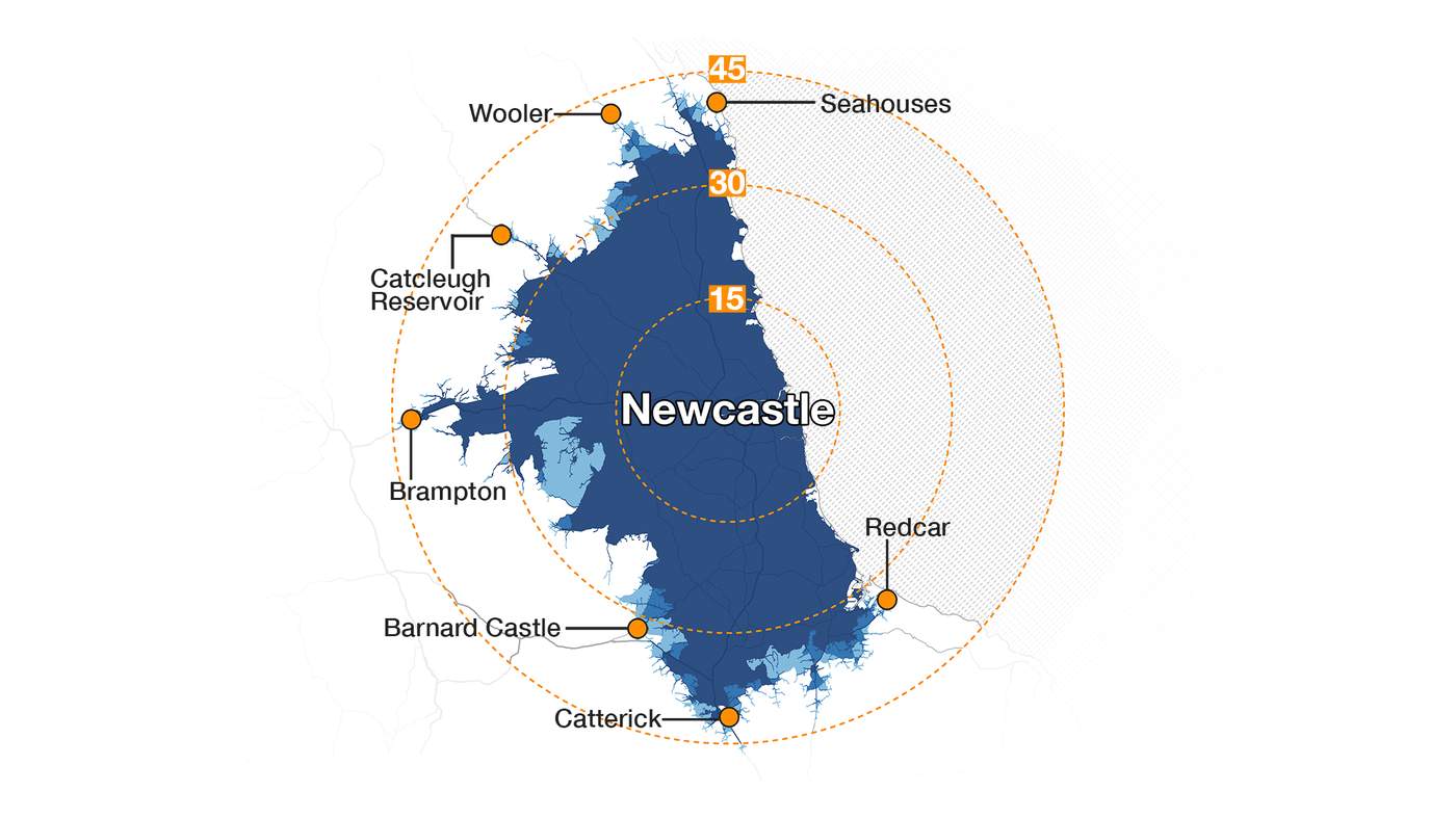
Newcastle upon Tyne
Start point: Newcastle Central Station
Map shows the furthest that can be travelled by road in 60 minutes on a typical Friday - if you leave at the following times:
Maximum possible distances
4pm = 44.5 miles
7pm = 45.0 miles
10pm = 46.6 miles

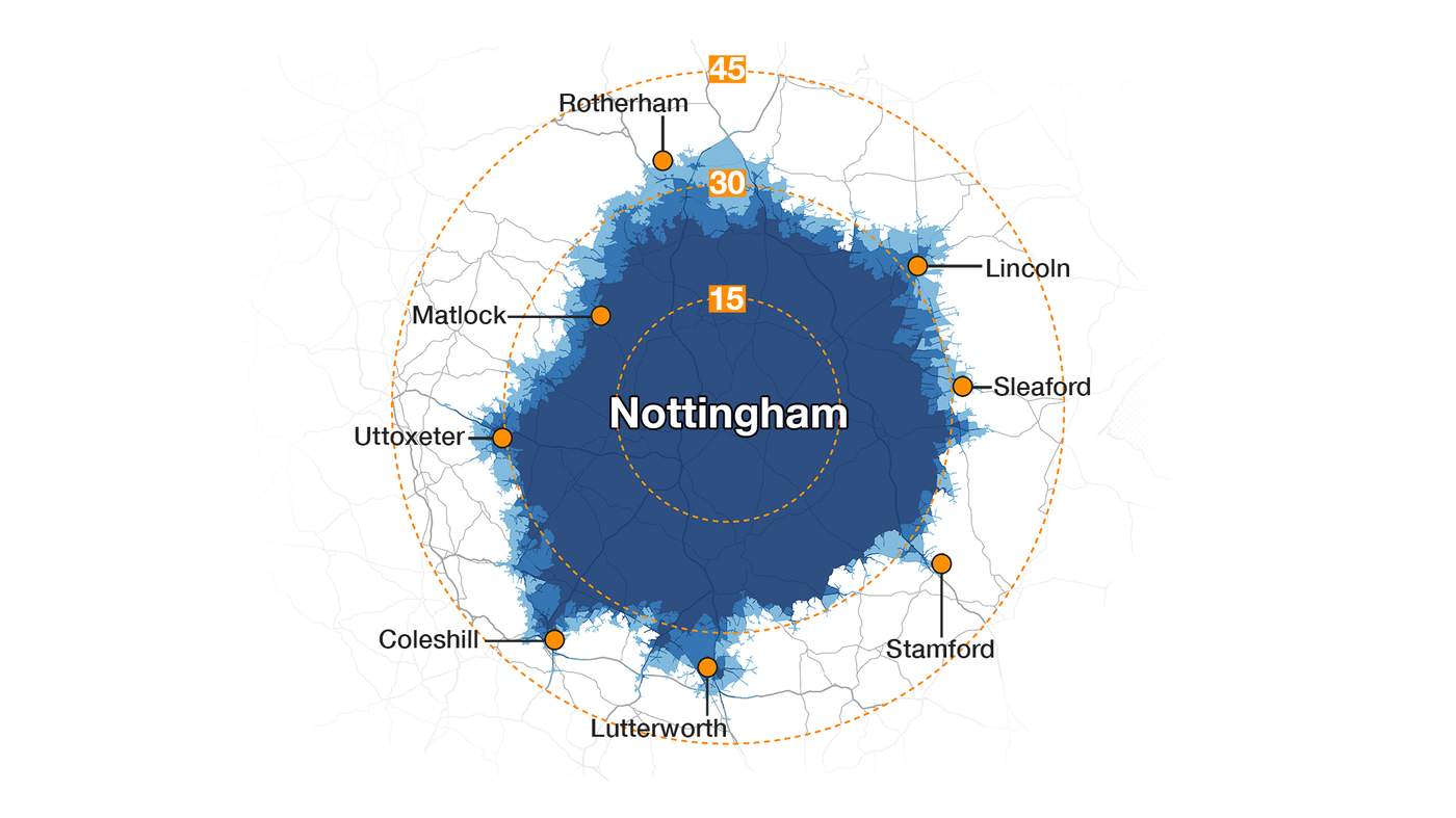
Nottingham
Start point: Exchange Arcade
Map shows the furthest that can be travelled by road in 60 minutes on a typical Friday - if you leave at the following times:
Maximum possible distances
4pm = 40.2 miles
7pm = 41.7 miles
10pm = 44.0 miles

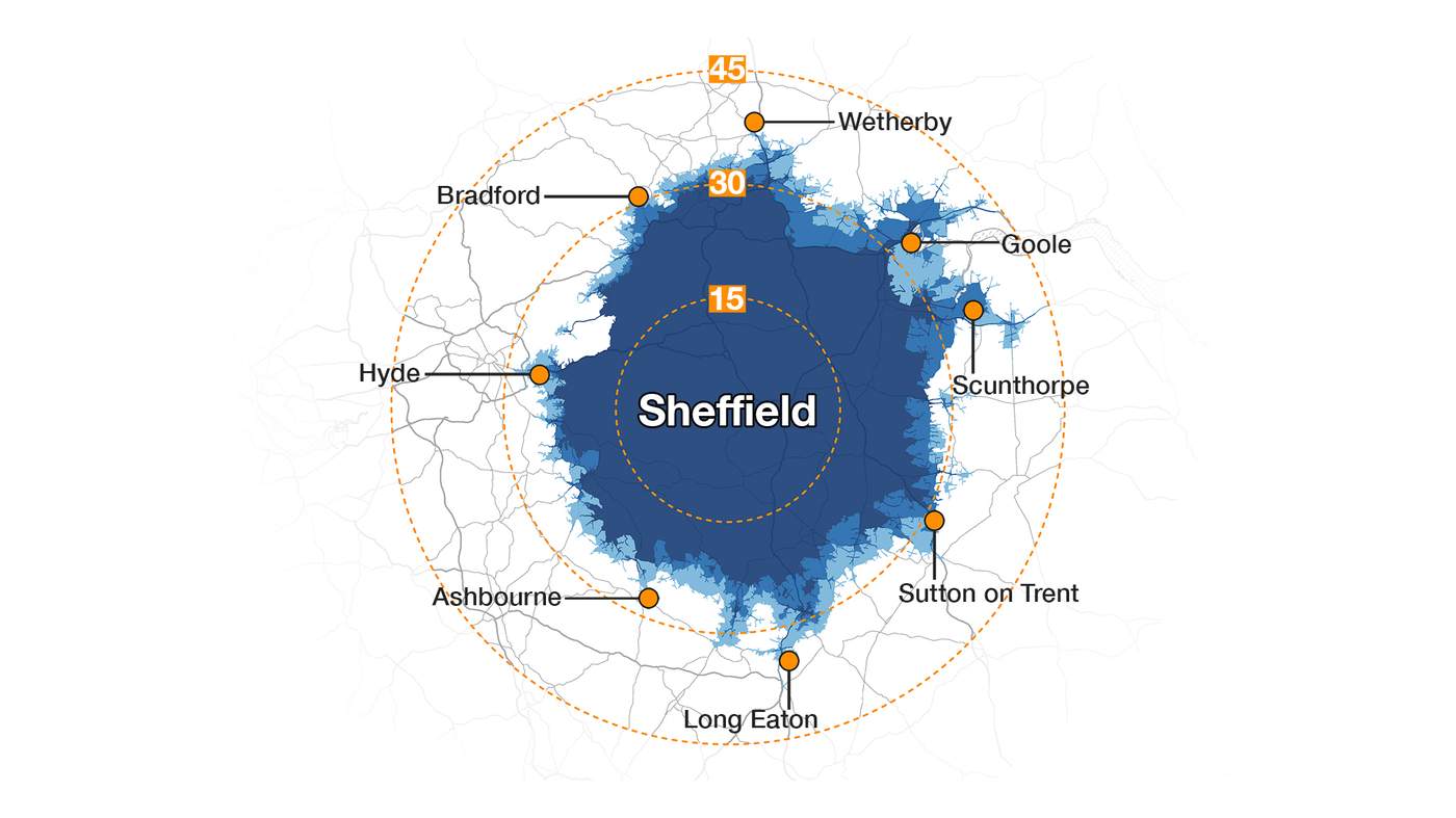
Sheffield
Start point: Sheffield City Hall
Map shows the furthest that can be travelled by road in 60 minutes on a typical Friday - if you leave at the following times:
Maximum possible distances
4pm = 38.4 miles
7pm = 44.3 miles
10pm = 45.2 miles