© Crown copyright. All rights reserved. BBC licence number 100019855, 2004.
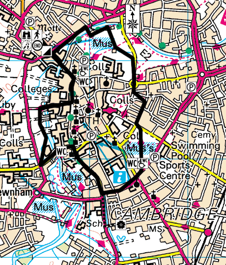
Start Point: Castle Mound, near Shire Hall on Castle Street, Cambridge
City Ranger Helpdesk: 01223 458282
Ordnance Survey: Explorer
Distance: approx 2.5 miles
Time: approx 2.5 hours
Walk Conditions:
Most of the walk is along concrete or tarmac paths and pavements although there are opportunities to go off-road and explore on the grass which can become muddy after rain. Castle Hill is the only steep section of the walk.
![]() Start the walk on top of Castle Mound on Castle Hill.
Start the walk on top of Castle Mound on Castle Hill.
This is the highest point in Cambridge at more than 25m above sea level! Many thousands of years ago, the top of Castle Hill was actually the bottom of a river! There's a gravelly ridge running from Castle Hill along Huntingdon Road, and deposits from this ridge date back from 200,000 years ago. This provides evidence of a huge braided river that would have flowed in this direction - a very ancient course of the river Cam.
Cambridge began on top of Castle Hill as a Roman garrison guarding the river crossing on the road to the north.
At the junction with Chesterton Lane, on the opposite side of the road you will see a tall pole which is a memorial to the Saxon graveyard found at this site four years ago.
![]() From the Saxon monument, walk along Chesterton Lane until you reach the bridge that takes you over the river onto Jesus Green.
From the Saxon monument, walk along Chesterton Lane until you reach the bridge that takes you over the river onto Jesus Green.
There's a deep channel which runs under Jesus College and Jesus Green, up to the Cambridge City football ground and then up to the Histon Road allotments. This 10-15 metre deep channel is another ancient course of the river Cam.
The City football ground used to be called Swan's Pit and deposits have been found there that show that they were formed about 180,000 years ago, under the warm climatic conditions that existed between two cold phases of the Ice Age.
![]() From Jesus Green, walk along the tree-lined footpath until you reach the main road (Victoria Avenue). Turn right and walk along the pavement - Jesus College gardens are on your right and Midsummer Common is on your left.
From Jesus Green, walk along the tree-lined footpath until you reach the main road (Victoria Avenue). Turn right and walk along the pavement - Jesus College gardens are on your right and Midsummer Common is on your left.
Jesus College used to be a nunnery called St Radegund's. In the late 1400's the Bishop of Ely - Bishop Alcock - turned it into a college, which is why you can see black cockerels in various places throughout Jesus College and on the coat of arms - it was Bishop Alcock's symbol.
Although Cambridge was founded way back in AD 70 the university didn't come to the city until the early 1200's.
![]() From Jesus College, head straight over the roundabout into Short Street, then turn left into New Square - a small area of grass with rows of terraced housing on three sides and the Grafton Centre off to the left.
From Jesus College, head straight over the roundabout into Short Street, then turn left into New Square - a small area of grass with rows of terraced housing on three sides and the Grafton Centre off to the left.
Beneath the Grafton Centre and along Newmarket Road, there's another ridge of gravel which indicates an ancient course of the Cam. Remains of reindeer, arctic foxes and mammoths have been found on Newmarket Road which are only about 20,000 years old and were formed during the last cold spell of the Ice Age.
The area where the Grafton Centre now stands used to be the village of Barnwell, which, perhaps wrongly, had a bad reputation for prostitution! Until the late 1890's the university had the right to send young girls who may be a threat to the male students to a prison called the Spinning House.
![]() Cross diagonally over New Square and walk down Clarendon Street towards Parker's Piece. At the end of Clarendon Street, turn left and walk up Parkside until the pedestrian crossing where you should cross over to Parker's Piece.
Cross diagonally over New Square and walk down Clarendon Street towards Parker's Piece. At the end of Clarendon Street, turn left and walk up Parkside until the pedestrian crossing where you should cross over to Parker's Piece.
Parker's Piece is another very flat area. Like Coldham's Common, it is under-laid by a large thickness of silt as it's an abandoned fossil flood plain. During the mid 19th century there was a mining rush on Coldham's Common as people dug for copralites which are black, phosphatic nodules. Copralites were also found under Parkside Swimming Pool.
The rules for football were first conceived and used on Parker's Piece and soon after were adopted by the Football Association. They are still used today, with only slight modifications and refinements!
![]() Walk diagonally across Parker's Piece towards the Catholic Church. Continue towards the main crossroads and cross straight over, and then over the road again, so you are right outside the Catholic Church. Carry on walking along Lensfield Road until you get to the junction with Trumpington Road where you will see the Hobson's Conduit Fountain.
Walk diagonally across Parker's Piece towards the Catholic Church. Continue towards the main crossroads and cross straight over, and then over the road again, so you are right outside the Catholic Church. Carry on walking along Lensfield Road until you get to the junction with Trumpington Road where you will see the Hobson's Conduit Fountain.
Hobson's Conduit was built in the early 1600's because there had been a lot of plague in Cambridge. Both town and gown realised that they needed to improve sanitation and provide a fresh water supply for the people in the city centre. Spring water comes from Nine Wells in Shelford and is then captured at Vicar's Brook and sent into town at various points - above and below ground. You can see the conduit running along the side of the road as you walk along Trumpington Street.
The conduit head (fountain) used to stand in the Market Square but was moved to Trumpington Road after a fire in the 1850's.
![]() Keep walking down Trumpington Street, past the Fitzwilliam Museum, then follow the road round to the left which turns into Silver Street. Walk over Silver Street bridge, where you will see the famous Mathematical Bridge on your right. Keep walking past Queen's College til you reach a grassy area called Queen's Green.
Keep walking down Trumpington Street, past the Fitzwilliam Museum, then follow the road round to the left which turns into Silver Street. Walk over Silver Street bridge, where you will see the famous Mathematical Bridge on your right. Keep walking past Queen's College til you reach a grassy area called Queen's Green.
Standing on Queen's Green, you can look up along Silver Street, across the traffic lights and up towards Sidgwick Avenue. Sidgwick Avenue is a flat terrace that runs across this part of West Cambridge. It's another ancient course of the river Cam.
In an excavation near the law faculty on Sidgwick Avenue they found plant remains and a huge bison skull which you can see the skull on display at the Sidgwick Museum.
![]() Keep walking along the path on Queen's Green. You're now walking on the Backs - the historic grassy area behind King's College. Walk along the path until you get a good view of King's College and the magnificent chapel.
Keep walking along the path on Queen's Green. You're now walking on the Backs - the historic grassy area behind King's College. Walk along the path until you get a good view of King's College and the magnificent chapel.
King's College is actually built on rubbish! Medieval waste was dumped off into the river and below the college you'll find hundreds of years of rubbish.
Looking at King's College is a reminder that the university makes Cambridge unique in that it provides magnificent architecture and landscaping right in the centre of town!
The course of the river Cam that you see today as you stand on Garret Hostel Bridge was formed about 10,000 years ago and has hardly moved from that course since!
![]() Go over the bridge and turn left once you reach Trinity Lane. Keep walking along Trinity Lane until you reach Trinity Street - where you will see a row of shops. Turn left and walk along Trinity Street and St John's Street.
Go over the bridge and turn left once you reach Trinity Lane. Keep walking along Trinity Lane until you reach Trinity Street - where you will see a row of shops. Turn left and walk along Trinity Street and St John's Street.
As you walk past the entrances of Trinity and St John's Colleges, it is another chance to admire the grand architecture.
Look carefully at the entrance to Trinity College and the statue of Henry VIII.. can you see what's wrong with it? You can also see an apple tree outside Trinity College which is allegedly grown from the seed from the apple tree that Newton sat under!
See if you can spot the fox disappearing into a hole with a goose or swan on the crest above the gates of St John's College.
![]() Turn left at the end of St John's Street at the Round Church and walk up Bridge Street towards the Quayside.
Turn left at the end of St John's Street at the Round Church and walk up Bridge Street towards the Quayside.
The bridge at Quayside was known as the Great Bridge and it was the main bridge in and out of Cambridge.
For centuries Market Square was the centre of town, but suddenly in 1845, the railway arrived and the river was used less and less as a means of transport and communication.
Cambridge continues to move and grow - how will it develop in the future?