
Early April showers turn very lively...
 Nestled amongst the frozen veg, meat and chips in our freezer is a little sealed bag containing a handful of hailstones.
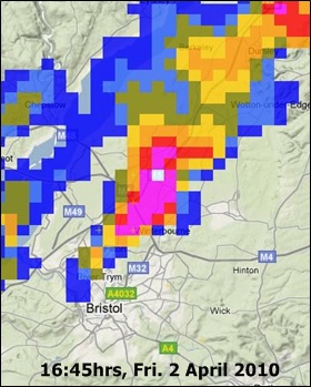
They're mostly about pea-sized, but nonetheless by far the largest I've seen falling here in Bradley Stoke for around a year or so. They arrived courtesy of a very lively thunderstorm yesterday (Friday) afternoon, which lit up the rainfall radar with very bright returns (see image, lower right) at about 5.45pm.
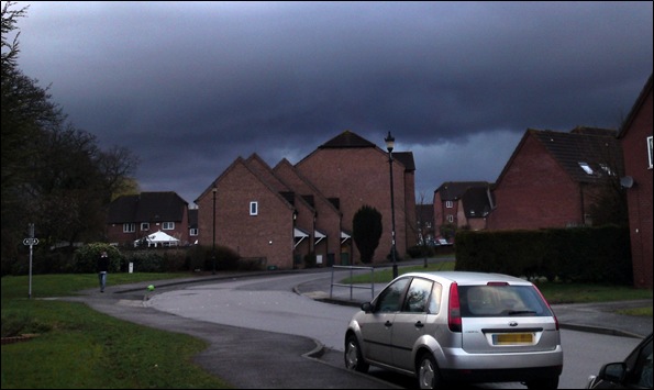
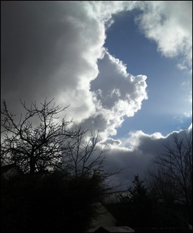
The skies had turned leaden across north Bristol as the impressive base of this Cumulonimbus rolled overhead, from which the distinctive white smears of falling hail were very visible. I explained how to spot these in an earlier blog.
And then down it all came... a spectacular and prolonged spell of hail, clattering on the roofs and quickly settling across pavements and lawns.
 This particular storm cell turned thundery right above my area and the Met Office's ATDNet lightning detection system - from which we can obtain very accurate time and location mapping for each cloud-to-ground flash across Europe - showed strikes around the M4/M5 Almondsbury interchange, only a mile or so from my location. It was the first thunder I'd heard in quite a number of months. Last year, we experienced surprisingly few days of electrical storms, at least here in this part of South Gloucestershire.
 During my morning shift yesterday on tv and local radio, I'd been mentioning the strong likelihood of some areas across the West Country seeing thunderstorms with hail during the afternoon. As a storm aficionado, I was delighted to have the most intense one showing anywhere on the radar deliver the goods right above my home!
I wasn't quite so delighted at the slow decay of the showers through the evening, however... we'd originally forecast them to dissipate more readily by early to mid evening, but a convergence zone kept them stubbornly persistant for some districts well past 9pm. Such is the nature of providing the breakfast time forecasts - in developmental situations such as yesterday, the local detail by evening is often impossible to accurately judge some 12 hours ahead...
 We're likely to see some further heavy showers - potentially turning thundery in places - throughout the course of today (Saturday) too. Low pressure is tracking east along the English Channel, offering an unsettled flavour to the weather across much of England and especially for southernmost counties, such as Dorset and Hampshire, across to the southeast, where the heaviest downpours are forecast through this afternoon. Some parts of the Home Counties, for example, can expect rainfall to exceed 25mm during the rest of the day.
Oh - and worth stressing that tomorrow (Sunday) looks a good deal quieter all-round! A ridge of high pressure will largely keep the showers surpressed across the West Country. Some further rain is expected by mid-week, but thereafter - as we approach next weekend - I'm hopeful we'll enjoy a spell of some mild, dry and settled weather.
UPDATE, MONDAY 5 APRIL:
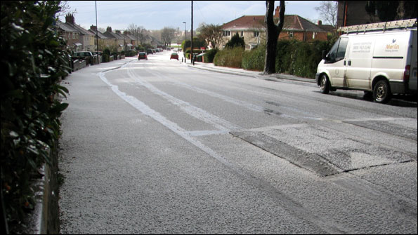
Many thanks to Nikki Bradley, who has sent me this great shot taken of hail completely coating Braemar Road in Filton, NW Bristol, from the same storm.
 I'm Ian Fergusson, a BBC Weather Presenter based in the West Country. From benign anticyclones to raging supercell storms, my blog discusses all manner of weather-related issues. I also provide updated race weekend forecasts tied to our BBC coverage of Formula One. You can follow me on
Comment number 1.
At 17:01 4th Apr 2010, Matty-H wrote:Hi Ian.
Karen and I were sat in the Starbucks coffee house just up the road from you by the Aztec Hotel when this storm struck. It was a cracker wasn't it? Our kids were outside afterward making snowballs with the hail that had fallen and left a slushy covering on the ground. I was stood under the canopy at the front door watching it happen. I didn't see any lightning, but heard it's thunder a couple of times.
As we drove back we caught up with the hail again at Latteridge on the way back to Yate.
As you say, thunderstorms were at a premium here last year. I suppose the dire summer and lack of any heat and humidity (June aside) didn't help.
Regards,
Matt
Complain about this comment (Comment number 1)