
It's Snow Fun on the Roads....
One of the advantages of getting underway to work at 0335hrs is the joy of seeing fresh, virtually unblemished snow that has fallen through the night.
One of the disadvantages is then driving in it. And nearly crashing.
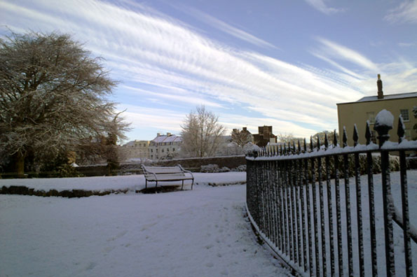
Snowfall early on Monday morning in Bristol - caused by a line of showers, focused off the Bristol Channel into a narrow swathe by converging winds - resulted in very localised scenes such as this (Photo: Dave Harvey)
Yesterday morning's journey to the BBC from Bradley Stoke was more akin to performing in one of those ice rallying events that the likes of Michael Schumacher occasionally participate in. Except, obviously, without his deft car control. Or crash helmet.
Treacherous road conditions from the snowfall overnight Sunday into Monday have proved a major news and general talking-point around Bristol the past 24hrs, but if you travel some 10 miles away from the city northwards, southwards or indeed westwards, you'd wonder what all the fuss was about.
This is because the snow was very localised - fed into a narrow swathe of North Somerset, Bristol, South Gloucestershire and North Wiltshire, but with rather little (or none) falling elsewhere that night.
The reason can be traced to the source: over the comparatively warm Bristol Channel (about 10C sea temperature), showers were able to build readily, fuelled by this warmth and given further emphasis as a low level breeze clashed and forced the growing cloud tops skyward.
As the showers blew-in eastwards on the prevailing westerly wind off the Channel, they readily changed complexion from rain and sleet-bearing on the coastal fringe of Somerset, to delivering snowfall inland. Temperatures in Bristol were down to around -1 at midnight and continued to fall steadily into the morning.
Filton, by way of example, recorded 3cm of lying snow by 4am on Monday morning - as I can attest from the amount I scraped off my car in nearby Bradley Stoke around the same time. Take a look at a selection of photos sent to us here.
The legacy has been a widespread freeze of lying snow and slush, with very limited thaw. My journey to work today (Tuesday) was a good deal quicker but no less hazardous - especially on suburban untreated roads, which would make very adequate arenas for impromptu ice hockey matches, but are no fun to drive along.
We're watching further snow showers this morning, feeding into parts of coastal Somerset and Bristol and born by effectively the same processes that delivered Monday's snow.
Nothing quite as heavy or problematic expected here today, however, but some small accumulations possible locally at least. We'll see further showers arrive from the west later on Wednesday too, but I'm not expecting them to turn quite so readily to snow.... but watch this space!
 I'm Ian Fergusson, a BBC Weather Presenter based in the West Country. From benign anticyclones to raging supercell storms, my blog discusses all manner of weather-related issues. I also provide updated race weekend forecasts tied to our BBC coverage of Formula One. You can follow me on
Comment number 1.
At 16:34 26th Dec 2009, Jack Mason wrote:Yes, apparently there is some mores snow on the way early next week is this true because here in the Forest of Dean we have already had 15 cms
Complain about this comment (Comment number 1)