
Deepest December snow since 1981
We have to go back to December 1981 for the last time we had so much snow on the ground in December in Yorkshire and Lincolnshire at this time of the year.
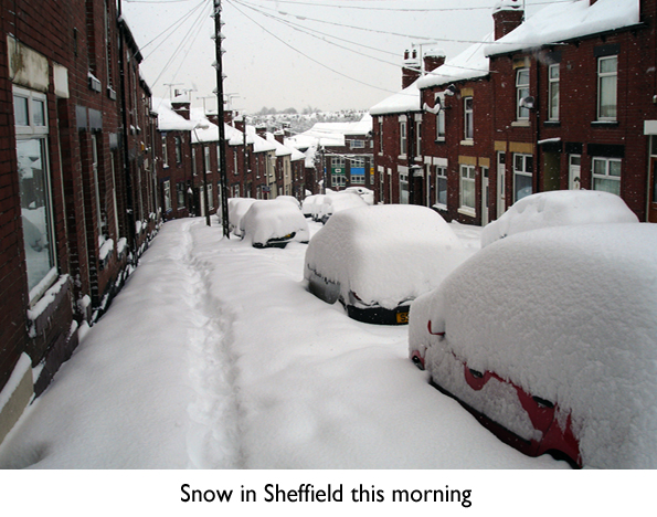
At midday today, The Peak District had 36cms of level snow. Some suburbs of Sheffield have 30cms, with similar amounts in Holmfirth, West Yorkshire. Parts of Lincolnshire have been very badly affected, with 30-45cms reported across some parts of the county. But it's the North York Moors which comes out on top - having snow depths approaching 50cms in the more exposed spots, with much larger drifts.
We still have a way to go to reach levels last seen in 1981, when parts of the Yorkshire Dales were buried under a metre of snow.
To put into context the current weather conditions, December 1981 was the snowiest of the 20th century. So what we are experiencing at the moment is rare.
Until the Northeasterly wind that is driving the snow in from the North Sea is cut off, we can expect more snowfall - but in a more showery form rather than the heavy continuous snow that we have had in the last 24 hours.
Current indications suggest these showers will start to die out on Thursday night. By Friday morning, temperatures could test those that were recorded last Saturday night, when minus 14C was recorded at Topcliffe, in North Yorkshire, as a ridge of high pressure pushes in from the west, leaving Friday much quieter.
So how long will the big freeze last?
From Friday conditions look set to quieten down, as pressure once again builds. A weather front on Friday night and into Saturday morning could give some snow, or even freezing rain. Other than that a lot of fine weather is expected, although severe frosts will continue with daytime temperatures still very much on the cold side.
Early next week the jet stream looks set to remain well to the south of its normal position.
Much of the action will be across Southern areas of the UK, as milder air attempts to push in from the south, bringing a risk of snow to this part of the country.
At the moment, although a minority of models do push that milder air much further north, most of the global forecasting models keep us in the cold - although not the exceptionally cold air that has been with us this week - with much more in the way of drier conditions - although wintry showers are still possible.
Worth bearing in mind that with extensive snow cover, severe frosts are likely to continue, and any thaw of lying snow will be very slow. Freezing fog could also be an issue, if winds fall light at night.
 Hello, I’m Paul Hudson, weather presenter and climate correspondent for BBC Look North in Yorkshire and Lincolnshire. I've been interested in the weather and climate for as long as I can remember, and worked as a forecaster with the Met Office for more than ten years locally and at the international unit before joining the BBC in October 2007. Here I divide my time between forecasting and reporting on stories about climate change and its implications for people's everyday lives.
Comments
Sign in or register to comment.