
A slow thaw. But for how long?
It's been one of the coldest starts to winter ever recorded (based on Central England Temperature (CET) records which started in 1659), with numerous local records broken.
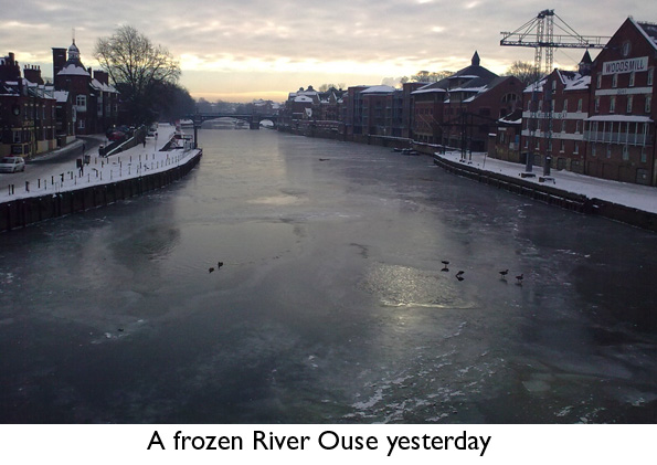
Such has been the intensity of the cold, rivers across Yorkshire have begun to freeze over, a rare phenomenon in itself, but virtually unheard of so early in the winter season.
But temperatures today reached 5C in the Vale of York, leading to a slow thaw of lying snow, as less cold Atlantic air arrived from the west.
Temperatures on Friday and Saturday will reach 7C in places, leading to a continued thaw of lying snow especially at lower levels.
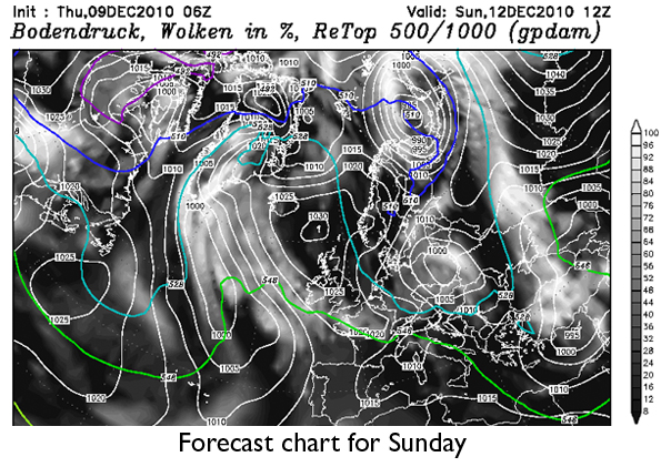
But there's no hope of a return to mild Southwest winds in the near future. Indeed, by Sunday, high pressure will begin to re-position itself to the north of the UK, with winds beginning to drift in from the east, as shown on the midday chart for Sunday, below.
The first half of next week looks colder than average, but fairly quiet, and certainly no where near as cold as the last few days, with daytime temperatures in the range 3C to 5C. There could be a few wintry showers, but quite a few places will stay dry, with slight to moderate frost at night.
During the second half of next week, nearly all the forecast models (with the exception of the European operational model which is in a minority) retrogresses the area of high pressure westwards, resulting in a very strong northerly pattern becoming established later in the week.
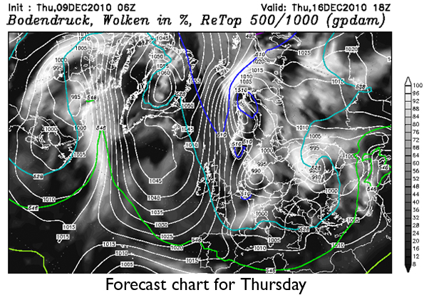
An example of what the atmosphere may look like can be seen below, again using the American operational model, this time for next Thursday.
After that there is an unusual level of agreement for so far ahead, between most models, that a very cold and potentially snowy pattern will become established.
North or Northeast winds will dominate the UK by the end of next week and into next weekend, with atmospheric weather patterns well blocked across higher latitudes.
Blocking patterns are very difficult to break down, suggesting a wintry scenario in the lead up to christmas.
If this is the case, then December could challenge 1981 for its severity, itself the coldest and snowiest December of the last century.
 Hello, I’m Paul Hudson, weather presenter and climate correspondent for BBC Look North in Yorkshire and Lincolnshire. I've been interested in the weather and climate for as long as I can remember, and worked as a forecaster with the Met Office for more than ten years locally and at the international unit before joining the BBC in October 2007. Here I divide my time between forecasting and reporting on stories about climate change and its implications for people's everyday lives.
Comments
Sign in or register to comment.