Energy and the John Muir Way
We need energy for lots of things at home, at school and when we're out and about. How that energy is generated and supplied can have a big impact on the environment.
In this article you can learn about:
- the John Muir Way
- different kinds of energy
- the impact on the environment of different energy sources
This article is suitable for learning about People, Place and Environment topics in primary school.
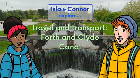
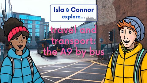
Video - Energy and the John Muir Way
Join Isla and Connor as they learn about different ways energy is generated, as they walk along the John Muir Way.
CONNOR: What a route The John Muir Way is, stretching across the whole country from Helensburgh in the west to Dunbar in the east.
Behind us is the site of the Cockenzie Power Station.
It used to generate electricity from coal.
ISLA: But not anymore?
CONNOR: Coal is the dirtiest of all fossil fuels.
It releases large amounts of carbon into the atmosphere when it's burned.
It provides lots of energy, but it's bad for the environment.
We need to stop burning fossil fuels so the carbon stays trapped inside them.
ISLA: What can we use instead?
What about that wind!
CONNOR: You got it in one!
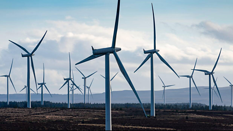
There are onshore wind farms across Scotland and offshore wind farms out at sea around the coast.
Collections of wind turbines harness the wind's incredible power.
The wind makes the blades of the turbine spin, which turns a rotor, which spins a generator, which creates electricity.
The power that they, and all forms of power station, generate feeds into the National Grid.
That's the network of cables that takes a power supply from a power station to the homes and businesses that use it.
ISLA: One day, we will run out of coal and other fossil fuels, but we definitely won't run out of wind.
That's why we call it renewable.
CONNOR: Ah, it's beautiful here.
This is the old Preston mill.
It was in operation until 1959, producing oatmeal.
The mill uses the energy from the moving water to turn the machinery.
The energy of moving water can be used to generate electricity too.
It's called hydroelectric power.
ISLA: That's another kind of renewable energy!
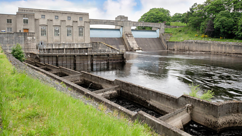
CONNOR: Glendoe Hydro Scheme is one of Scotland's hydroelectric power stations.
The water collected via a network of tunnels rushes down from the reservoir and through the turbines that turn generators to produce electricity.
ISLA: Wow! Incredible!
Let's crack on!
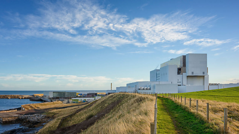
It's Torness Nuclear Power Station.
It powers around two point seven million homes.
CONNOR: Nuclear?
Is that a green energy or not?
ISLA: It's low carbon, which is good.
And it is a really reliable source of energy which means we can control how much is generated, unlike some renewable sources like solar and wind, which depend on the weather.
But nuclear creates other environmental concerns.
You know how everything in the world is up of tiny building blocks called atoms?
Well, nuclear energy comes from splitting atoms.
This releases lots of energy as heat and radiation.
The heat boils water into steam.
The steam is then used to turn a turbine that drives generators to make electricity.
Sea water is used to cool the steam and turn it back into water, so it can be re-used, but it also creates a radioactive waste that has to be disposed of very carefully so it doesn't pollute the environment or harm people's health.
And to power a nuclear power station, you have to use the atoms from a rare metal called uranium.
Most uranium is mined from the earth and this process is damaging to the environment.
Wind and hydro are the most important renewable energy sources for Scotland.
CONNOR: Tidal and wave energy from the sea are other possible energy sources for Scotland.
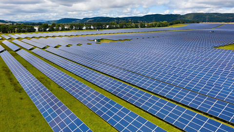
ISLA: We also use solar power.
It's amazing how we can convert energy from the world around us into power in so many different ways.
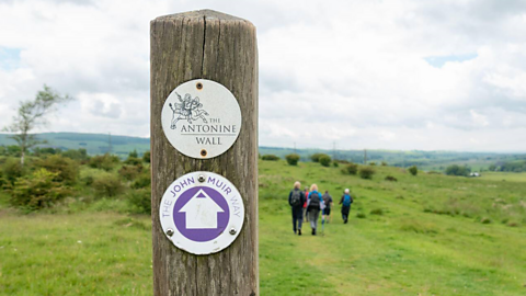
What is the John Muir Way?
Who was John Muir?
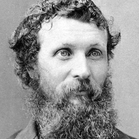
John Muir was born in Dunbar in 1838. His family left Scotland for America when he was ten years old.
He became famous for his writing about the natural world, studying rocks, plants and animals, and his work preserving and protecting areas of outstanding beauty, including Yosemite National Park in California.
The John Muir Way was opened in 2014 to mark the 100th anniversary of his death.
Where does the John Muir Way start and end?
The John Muir Way runs between Helensburgh on the west coast of Scotland, (the port where Muir left Scotland for America), and Dunbar on the east coast (where Muir was born).
The route is 134 miles (215 km) long, and is popular with walkers and cyclists.
Click through the slideshow below to find out about some of the interesting places you might visit along the John Muir Way.
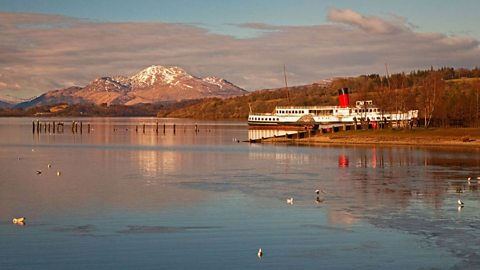
Image caption, Loch Lomond
The first stretch of the John Muir Way begins in Helensburgh and ends at Balloch, on the shores of Loch Lomond. This is a popular spot for visitors, and it is very fitting that it is in the Loch Lomond and the Trossachs National Park. John Muir was one of the key figures in establishing the very first National Parks, in America in the 1860s. (Phil Seale/Alamy Stock Photo)
1 of 10
Sources of energy
Energy can be generated from many different sources. Some of these sources are less harmful to the environment than others.
There are two types of energy: renewable and non-renewable.
- Renewable energy sources include the sun, sea and wind.
These sources are not used up when we use them to generate energy. That means that they are renewable. Developing new technology like solar panels to heat homes encourages people to use more renewable energy and helps the environment.
- Non-renewable energy sources include coal, oil and gas.
These are burned to release the energy they contain, which also releases harmful gases into the air. Once fossil fuels are burned, they are used up. This makes them non-renewable. Most vehicles use non-renewable energy, and that is why they are harmful to the environment.
Here are some examples of both types of energy sources.
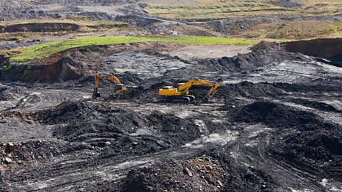
Image caption, Coal
Coal is a non-renewable energy source. It is made from ancient trees which have buried under soil and other material, creating huge pressure. This pressure, along with natural heat from the core of the Earth compresses the trees and other material to form coal. To use coal as a fuel, it has to be excavated or mined from the ground, and then burned. This picture shows Glentaggart open-cast mine in Lanarkshire, which closed in 2011. Open-cast mines are where coal is close to the surface and can be reached by removing the layers of earth and rock above the coal. (Global Warming Images/Alamy Stock Photo)
1 of 6
Energy in Scotland
In Scotland, we no longer mine for coal. This was a huge change in industry in areas like Ayrshire, Fife and Lanarkshire that had many mining communities. Many people were left without work and had to retrain to find jobs in different industries.
Nuclear power production is also coming to an end. The only remaining operational station is Torness, in East Lothian, and that is due to stop generating electricity in 2028.
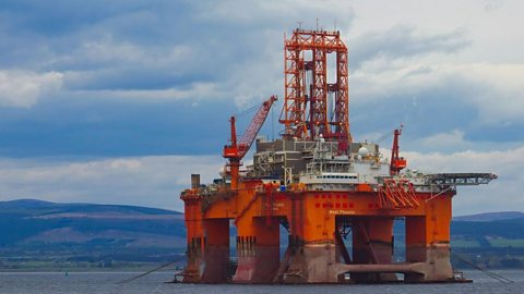
Even though people are concerned about climate change and damage to the seabed, oil and gas drilling in the North Sea continues to provide fuel for transport, heating and for generating electricity. However there are plans to reduce how much we use fossil fuels. Scotland has a target that by 2030, half of heat, transport and electricity use in Scotland will be from Something that does not run out when used. energy sources.
Learn more about different types of energy here: Energy sources and sustainability

Key words about energy
Check your connection, refresh the page and try again. - useable power, usually taken from other resources
Check your connection, refresh the page and try again. - energy from a source that can be easily replaced or replenished, including wind and solar
Check your connection, refresh the page and try again. - energy from sources that cannot be easily replaced or replenished after use, including oil and gas
Check your connection, refresh the page and try again. - natural fuel such as coal and gas, made from compressed fossils
Check your connection, refresh the page and try again. - an area of the countryside that is protected by law to look after the landscape and wildlife.
Test your knowledge
Quiz
Challenge

Design a poster to appear at key points along the John Muir Way to encourage visitors to take care of the environment.
Have a think about:
how to make it eye-catching (maybe a slogan, or an image)
what might persuade people to think more about the environment and make changes
how you can appeal to the people who use the John Muir Way to look after it.
Learn more about designing posters with 2nd level English and literacy: How to make a poster
Our landscape
Young people who live in communities along the John Muir Way worked with the LAB team at BBC Scotland to make short films about some of their local landmarks. Watch as they share information about their local community, in the past and the present day.
Hi, I'm Chloe and I’m Cael. We are primary six pupils from Bonnybridge Primary School. We are going to be sharing the history of the Antonine Wall.
The Antonine Wall is a short walk from our school. But what is it and why is it so important? We are here to tell you all about it. The Antonine Wall was built by the Romans to show their power across the land. It was a physical barrier to mark the northernmost part of the Roman Empire. The wall was made out of turf, rock and wood. There was also a ditch that ran alongside the wall. It runs between the Forth and Clyde rivers in Scotland.
Construction of the wall began around 142 AD. The wall was 37 miles long and around 3 metres high. The Romans were the people who came from Rome in what is now Italy. The Romans conquered lots of territories to build the Roman Empire. There is another famous wall built by the Romans. It is located in northern England, known as Hadrian's Wall. Rough Castle Fort is near Bonnybridge and is a great place to see the wall and pits. Some families were split apart on either side of the wall. They lived in stone roundhouses with straw or stick roofs. It must have been very tiring for people building the wall. It must have been scary and intimidating for local people to see the wall for the first time.
Some of the best sections that can be seen near Bonnybridge are the ditches which run alongside the wall. I visited last year with my mum and dad. I saw steep grassy hills and a toad in one of the spike pits. I saw lots of oak trees and had an amazing day. I went there last month with my cousin. We pencil rolled down the hill into the ditch. What I found really extraordinary when I went was the wee ditches in the ground that used to have spikes. Thank you for watching our short film. We hope you learned some interesting facts about the Antonine Wall. Why not come and visit soon?
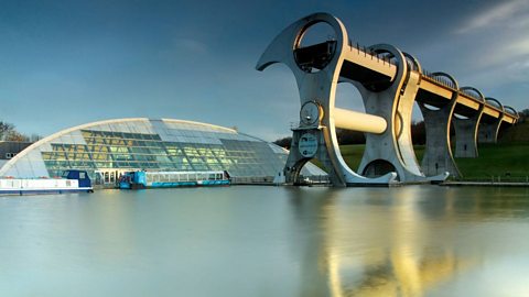
Hi. We’re students from Easter Carmuirs Primary and this is a film about the Falkirk Wheel. Our school is the closest to the Falkirk Wheel. And we are here to tell you some facts. So what is the Falkirk Wheel?
The Falkirk Wheel is the world’s only rotating boat lift. It’s an iconic Scottish landmark with state of the art technology. The design of the wheel is based on ideas from the Ancient Greek engineer Archimedes. The wheel was built in England and moved to Falkirk. It was opened in 2002 by Queen Elizabeth II and was designed to last 120 years. The wheel lifts up canal boats from the Forth and Clyde Canal to the Union Canal 35 metres above. To do that it only takes around the same amount of power used to boil eight kettles. The wheel helps boats navigate from coast to coast through Scotland's canals. It has made Falkirk a key tourism destination. People travel from all over the world to visit. It is one of the most popular tourist attractions in Scotland because it has over half a million visitors each year.
Here are some of our own stories about the Falkirk Wheel. I like going on the boat and around the wheel, it is so much fun. At night when I go for a walk at the Falkirk wheel it lights up and changes colour. It looks fantastic. I like going down the slide at the play park because they have turns and they're really fast. I like going through the tunnels and once I made a video with my toys in there. I love all the activities like bumper boats and crazy golf. Thanks for watching and we hope you learned something new.
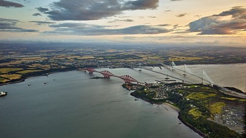
We are pupils from North Queensferry Primary School and this is our video about the most important landmarks near our school.
Before the bridges were built, ferries ran between North and South Queensferry dating back to the 12th century. The villages were named after Queen Margaret. Over time, the ferries were replaced by three bridges, one for the trains and two for motor vehicles. Here are some facts all about our amazing bridges.
The Forth Railway Bridge is one of Scotland's most famous landmarks. It is a UNESCO World Heritage site. It was opened in 1890 by the Prince of Wales. It runs between Dalmeny and North Queensferry stations. Over 4000 men were involved in its construction and it took around seven years to complete. 6.5 million rivets were used in the making of the bridge. The bridge is 2467 metres long. The highest point of the bridge stands at 110 metres above the river.
The Forth Road Bridge is a suspension bridge and its towers are 156 metres tall. The bridge was designed by architect firms Mott, Hay and Anderson and also Freeman Fox and Partners. It's one and a half miles long and is a category A listed building. The bridge connects Fife to the Edinburgh area. It contains 39000 tonnes of steel and it cost £19.5 million. It was opened on September 4th, 1964, by Queen Elizabeth II. When it opened, it was the longest bridge of its kind outside of the USA. The Road Bridge closed as it had exceeded its design capacity. It closed for cars in August 2017, but is still open to buses, some motorbikes and taxis.
The Queensferry Crossing is the newest of the three bridges in our local area. It took six years to build. It was opened in 2017 also by Queen Elizabeth II. It’s the longest three tower cable-stayed bridge in the world. The towers are 210 metres above the high tide mark in the river. That’s around the same height as 48 double decker buses. It is 2700 metres long. It contains the same amount of steel as 200 large passenger jets. Thank you for joining us. We hope you learned something new. Bye.
More to learn about energy and the John Muir Way
Energy and sustainability
Learn more about types of energy and sustainability with our topic
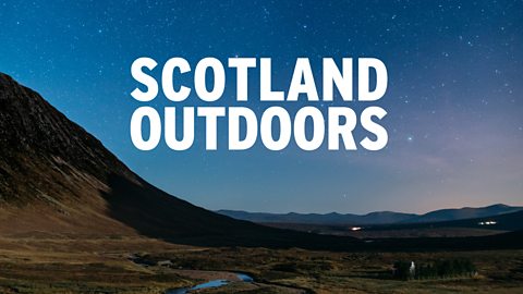
The John Muir Way audio
Listen to this episode of Scotland Outdoors where Mark and Euan walk the John Muir Way
How to make a poster. video
Make your poster eye-catching by following these simple rules
More on Landscapes
Find out more by working through a topic
- count6 of 25
- count7 of 25