What do you need to know?
To read a map you need to understand:
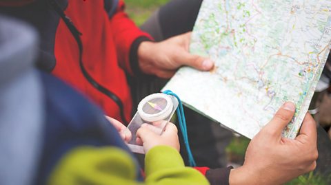
- what directions mean and how to use a compass.
- grid references.
- how to find what symbols mean by using a key.
- which type of map you are reading, for example, Ordnance Survey (O/S) maps, street maps, atlases and globes.
Watch: Reading maps
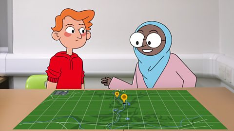
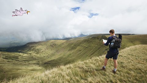
Play the video to watch Ayesha and James learn how to read maps so they can find the treasure.
Dad: OK, so here’s the treasure map. ‘X’ marks the spot!
James: Awesome! I can't wait to find out what the treasure is!
Ayesha: We’ll need a compass.
Dad: Do you remember how it works?
Ayesha: It has four main points: north, east, south and west. The needle in the middle always points north. Look! Even when I turn the compass, the needle still points in the same direction.If we turn so that north on the dial lines up with the point of the needle, it means we’ll also be facing north. Now we can work out where east, south and west are too!
James: Ah, so that church is to the west of us and that park is to the south of us.
Ayesha: Hmm. Where's that red lake? I can't see it anywhere!
James: Oh! That was me, sorry!
Ayesha: What are those lines on the map?
James: Those help to show exactly where things are.Look! Do you see that park on the map?
Ayesha: Yes!
James: There are two lines that meet, and if you follow the lines to the edge of the map, they each have a number.So that park is at… 33,11.
Ayesha: Can I try?
James: Sure! Remember though, we have to read the number that goes across the bottom before we read the number going up the side.
Ayesha: So we could say that we go along the hallway and up the stairs.
James: Haha, I suppose so.
Dad: The map shows the treasure is at 36,11.
Ayesha: So it’s here!
James: So the treasure is there and we’re here, which means we need to go south.
Ayesha: So we need to go that way!But dad… there’s nothing here.
Dad: Look at that view.
James: Woah!
Dad: That’s the real treasure.
James: It’s beautiful!
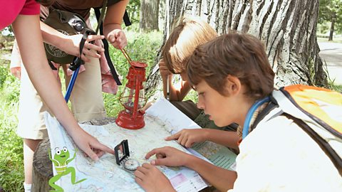
Grid references
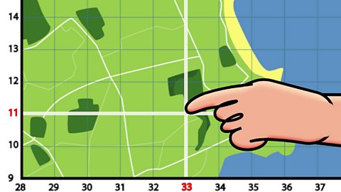
This person is pointing to the park. It is located where two lines cross. If you follow the lines to the edge of the map you will see a number.
Tip:
First you find the number that goes across the bottom, which is 33 here.
Then you find the number going up the side, which is 11 here, so the grid reference is 3311.
You may see brackets around a grid reference and a comma to separate them, for example: (33,11).
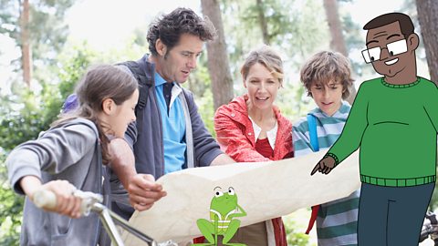
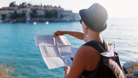
Watch: Navigating the UK
The UK is made up of different countries, counties, towns, cities and villages. It also has lots of geographical features like mountains, rivers, forests and motorways. Maps can help us explore and find out more about landscapes.
Learn more about using maps in the UK in this BBC Bitesize for Teachers video.
De-Graft: The United Kingdom of Great Britain and Northern Ireland, or the UK as it’s known, is made up of different countries, communities, and environments. There are loads of things to see and places to explore – for example, did you know, that there are more than two thousand miles of canal towpaths?
This is Manchester. Here waterways or canals were once the main way of transporting raw materials and trading goods, but now they’re used primarily for leisure.
Later, locals Haniyah and Lola will be helping me understand a lot more about using a map to navigate around the UK. But first, let's zoom out.
I’m here in Manchester, one of the biggest cities in England. The UK is made up of four countries: England, Scotland, Wales and Northern Ireland, which can be found on the two largest islands within the British Isles. The biggest island is called Great Britain, which contains England, Scotland and Wales.
The UK is made up of different communities, rural and urban, that are distinct and have unique traits. As you can see on this puzzle, in England the country is divided into different areas called counties. In Northern Ireland there are districts, Wales there are principal areas, and in Scotland there are council areas.
We call all the places that people live in ‘settlements’, and there are a few different shapes and sizes. A hamlet is a very small settlement, with just a group of houses. A village is also small but as well as houses, there may be a shop, a school, a place of worship or a village hall. A town has all of the same features as a village but there may also be a railway station, a shopping centre, more places of work and places of worship. A city is even larger. Cities have a lot of housing, schools, universities, hospitals, offices, and often a cathedral. And a megacity are when a number of large towns and cities combined to create a massive urban area.
OK, time to compare. Across all of the settlements in the UK, in England, Scotland, Northern Ireland and Wales, there’s a total population of over 66 million people spread out over 242,500 square kilometres.
The USA has around five times more people, living in an area of over nine million square kilometres.
Looking at maps is a great way of spotting settlements and locals Lola and Haniyah have joined me on the outskirts of Manchester to have a go.
So guys, what do you make of this view around us?
Children: I think it’s really nice, it’s got lots of buildings.
I think it’s a nice, calm, relaxing view.
De-Graft: We’ve got all the nice scenery behind us but in front of us we’ve got a big, old map. What kind of things do you use maps for?
Lola: It tells you how to get to places or where places are.
De-Graft: Absolutely right! Maps are two-dimensional drawings of an area, and they can be digital, like on our phones, or on pieces of paper. But we don’t just have a map in front of us, we’ve also got a compass. Haniyah, can you grab the compass and show us where north is?
Haniyah: So north, if I point the compass like that, would be facing there.
De-Graft: Very nice work. Maps are drawn to a much smaller scale so they can fit everything on a piece of paper. So, the map we've got in front of us is a 1:25000 scale map. That means every four centimetres on the map is the same as one kilometre in reality.
Now I’ve got a bit of a challenge for you guys. I need you to get your rulers to tell me how far is Salford Quays from Manchester City Centre.
Haniyah: 12 centimetres but in real life it would be three kilometres.
De-Graft: That’s right, three kilometres ‘as the crow flies’ or if you were to draw a straight line.
So why don’t you have a go at map reading and plan some local routes to some nearby places. Zoom in and have a go for yourself.
Right guys, where are we off to next? Cool, let’s go!
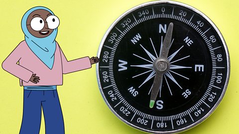
Compass points
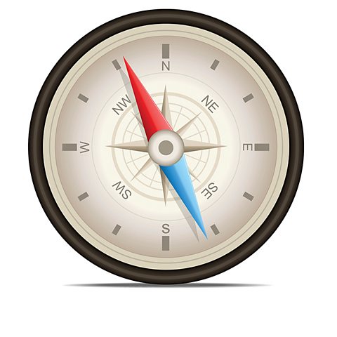
Sometimes the direction you need to take isn’t exactly north, east, south or west and it might be in the middle of two points:
- north-east (NE) is in-between north and east.
- south-east (SE) is in-between south and east.
- south-west (SW) is in-between south and west.
- north-west (NW) is in-between north and west.
Map-reading tips
Take a look at useful tips with compasses and maps:
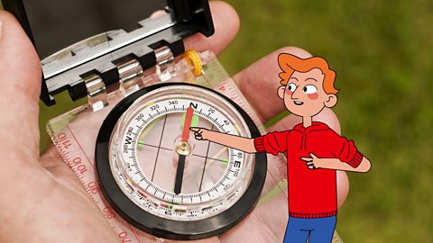
Image caption, Finding north
To find north, hold the compass in your hand and turn around until the coloured needle points to ‘N’.
1 of 6
Did you know?
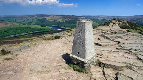
Ordnance Survey or O/S maps cover the whole of the UK. After World War One, over 6,500 triangulation stations (like the one in the photograph), also known as trig points, were built across the country. Surveyors (people who observe the condition of land) placed their measuring instruments on them.
Today this method has been replaced by planes and digital photography, but many trig points can still be found around the UK.
Activity: Quiz – Map-reading
Race Across the Continents game - new update! game
Help this team of adventurers race their way to victory. Explore the globe in this exciting game update to discover new audio voiced by Ade Adepitan and fun animations. Challenge yourself with brand-new achievements and become a high-flyer!

More on Fieldwork
Find out more by working through a topic
- count2 of 12
- count4 of 12