Case study - the Lake District, England
Helvellyn stands is one of England's highest mountain, standing at 949 metres above sea level in the Lake District in north-west England. It is made up of igneous rocks which were formed 450 million years ago.
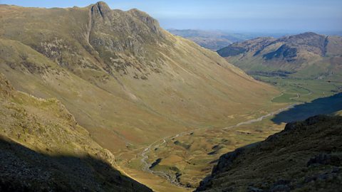
Many of the landscape features visible around Helvellyn today were formed during the last ice age over 20,000 years ago. Large glaciers dominated the landscape and through their erosive power, carved out classic glaciated landforms such as A sharp ridge of rock separating two corries., A bowl-shaped hollow area formed by glaciation, sometimes containing lakes or 'tarns'. Corries are also known as cirques or, when found in Wales, cwms. and A deep U-shaped valley formed by a glacier..
Helvellyn is a mountain, which contains several glacial landforms. Two arêtes ascend to the summit of Helvellyn, Striding edge and Swirral edge. Striding Edge forms the back wall of the Red Tarn corrie.
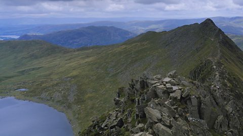
Red Tarn is an example of a corrie on the eastern side of the summit of Helvellyn. It has the following distinctive features:
- steep back wall, created by When water in rocks freezes and expands, breaking the rock apart. and A type of glacial erosion that occurs when ice freezes onto the landscape, ripping out rocks when it moves.
- steep-sided and narrow ridges called arêtes
- a corrie lake or tarn
To the east of Helvellyn is Ullswater. This is a A long narrow lake found in a glacial trough. which occupies a A deep U-shaped valley formed by a glacier. (a U-shaped valley).
In other parts of the Lake District, boulder clay has been deposited in the valley bottoms as drumlins.
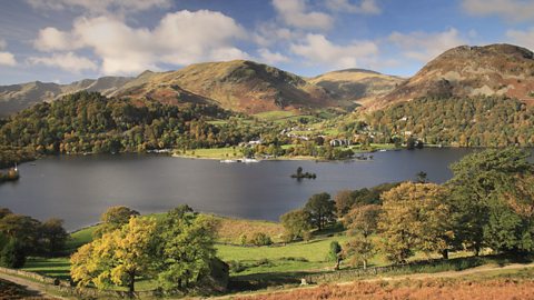
Image caption, Ullswater is a ribbon lake
1 of 3
