THE WALK
Distance: 7.5 miles
Grid reference at start: SU483838
Time: 3/4 hours
Going: Easy
Parking: In car park beside Ridgeway at grid reference above, and in car park at Lardon Chase.
BBC BERKSHIRE WALKING AND SAFETY | 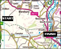 |
From the car park, walk in an easterly direction onto The Ridgeway, with the A34 to your left. Follow The Ridgeway as it dips down underneath the A34. 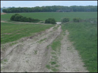 | | Much of The Ridgeway is rutted and can be difficult to pass after heavy rain. |
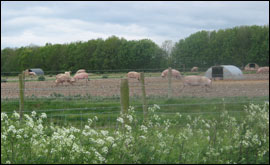
Follow the path as it bends round to the left. Keep to the main Ridgeway path, seeing some corrugated pig sheds on the right, and Didcot Power Station behind and to your left. As the path is crossed by others, continue following the main Ridgeway. Look out for a tap on the right for drinking water by the entrance to a farm. As a Byway crosses The Ridgeway, continue straight ahead on the main track. 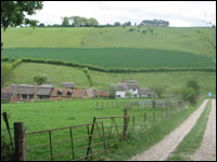 | | The Ridgeway passes mainly over farmland and woodland. |
Look out for the sign directing you left following the main Ridgeway path. You should be able to see electricity pylons straight ahead of you. You should now see Didcot Power Station to your left. The path descends towards Streatley and becomes a tarmac road. Stay on the tarmac road and don't take the footpath on the right by Wynders. Go past Thurle Grange Farm on your right and see the golf club ahead and on your right. 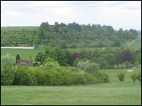 | | View from the top of the golf course. |
See Thurle Grange on your left. Follow the road past Golf Cottages on the right and take the footpath directly after the cottages on the right. Follow the footpath sign straight across the golf course, as it slopes quite steeply upwards. The path continues out of the golf course, into woods, bearing right. This will get you to the car park at Lardon Chase where you should have left your second car, the end of this part of the Berkshire Way. You've completed Part Seven of the Berkshire Way Well Done! Berkshire Way Part Eight |