THE WALK
Distance: 7.5 miles
Grid reference at start: SU326789
Time: 3 to 3.5 hours
Going: Moderate
Parking: Car parks in the centre of Lambournand Hungerford
BBC BERKSHIRE WALKING AND SAFETY | 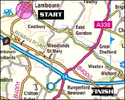 |
The walk starts in Lambourn, so you need to park one car at the finish in Hungerford, there are several long-stay car parks in the centre. 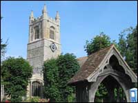 | | This is where the walk begins, you can see the church tower across Lambourn |
Park the other car in Lambourn, in one of the free car parks off the High Street, and walk to St Michael and All Angels Church. From here, walk back down the High Street, past The George Pub on the left. Follow the road for approximately 300 yards. Directly after you walk past a left turning to Edwards Hill,you'll see a house on the left. After the house is a footpath, turn left up the footpath. The footpath is on a slight incline and is a bit stoney underfoot. The footpath ends, continue on a tarmac road, past Lambourn C of E School on the left. Good views of Lambourn village behind and to the left. 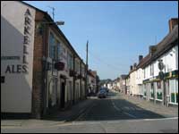 | | View of The George on the left, down the High Street |
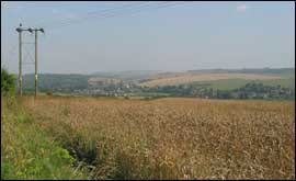
Continue on the byway, past Meridian stables onto White Shute Track. Continue to follow the byway when it is crossed by a footpath and becomes Stoney Lane Track. Continue to follow the byway until it is crossed by another track at a thatched cottage. Take the track ahead keeping the cottage on your left. The byway can get boggy here after bad weather.Pass Burgess Farm on the left, to meet the B4001 Roman Road. Turn left onto the Roman Road. This is a busy road so keep to the verge. At the staggered junction, turn right. 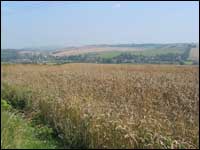 | | Lots of opportunities for taking good photos here |
The road has signs on it saying Inholmes, and you will also see a footpath sign. Cross the M4 motorway over the bridge. When you reach the entrance gate for Inholmes House only, go to the left of the gateway and follow the footpath. Follow the path with trees on the left and a field on the right. At the end of the field, bear slightly left through the woods. It was quite overgrown when BBC Berkshire walked this stretch in August 2002, but passable. At the end of the wooded stretch, follow the footpath left into the field with the field on the right. Continue straight on, with woodland to your right. See Gallows Down and Walbury Hill to the right, follow path straight through field. When you meet the road, turn right. When you meet the junction at Haywards Bottom, turn left. 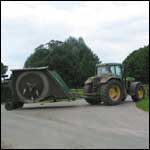 | | You may see the odd tractor but that's about it as far as traffic is concerned |
After 200 yards turn right, signposted to New Hayward and Leverton. Views of Hungerford to the left. At the crossroads follow road to Eddington and Hungerford. Pass a house on the right with wooden shutters, and wood cladding, painted peach. Directly after the house, turn right down a narrow path. Keep right. 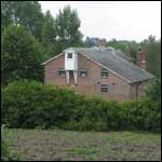 | | Pass this old Mill on the right |
After approximately 50 yards, go straight down a footpath between two houses (coming off the road) and crossing a wooden footbridge.Follow the path with a stream on the left and the River Kennet on the
right. When you reach the road bridge, turn right up onto the bridge, and walk over it.Follow the road sign to Marlborough, Salisbury and Swindon. Walk alongside the Texaco petrol station on the left. Walk past the Lamb Inn on the left. Turn left at the mini roundabout by The Bear at Hungerford, following the road sign to Town Centre. 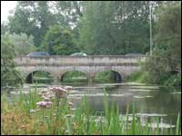 | | You'll see this picturesque bridge as you come into Hungerford |
Pass the John O'Gaunt Inn on the left. Walk over the bridge across the Kennet & Avon Canal into the town. Directly after crossing the bridge, turn left and go back on yourself, underneath a wrought iron footbridge to a private house, to join the towpath on the canal. Turn right onto the towpath.When you reach a footbridge across the canal, turn right, off the towpath and towards the station. You've completed Part One of the Berkshire Way Well Done! Berkshire Way Part Two
|