The eruption of the Icelandic volcano Eyjafjallajokull has brought disruption to the skies over Europe.
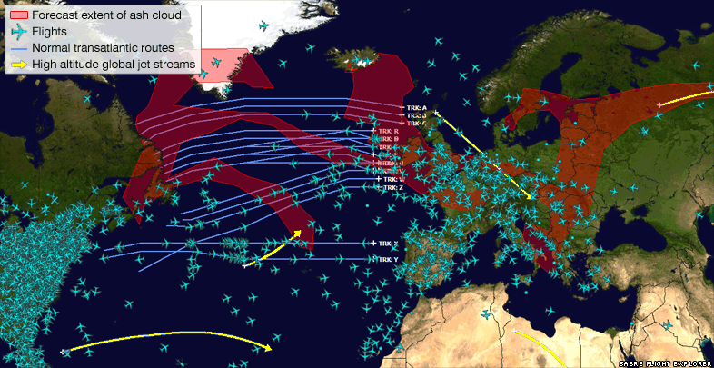
The maps above show how flights have been restricted to flying around the ash cloud, shown in red. Where the shading is darkest, it indicates the cloud is extending higher into the atmosphere.
The flight ban was partially lifted on Tuesday - five days after the eruption. EU transport ministers agreed to allow limited flights within Europe after flight tests showed the density of the volcanic ash in the air was diminishing.
Meteorologists have been using computer models to predict which direction the ash cloud will travel.
The map above, provided by the Met Office shows how the ash cloud is forecast to alter its position in the next 24 hours.
Scientists and engineers have agreed a new safe threshold - a concentration of ash of 0.002g per cubic metre of air. At or below this concentration, there is no damage to aircraft engines.
Latest weather reports from the BBC Weather Centre suggest the wind direction is changing and this should blow the ash cloud away from the UK and other parts of Western Europe, by the weekend, clearing the skies for normal flights to resume.
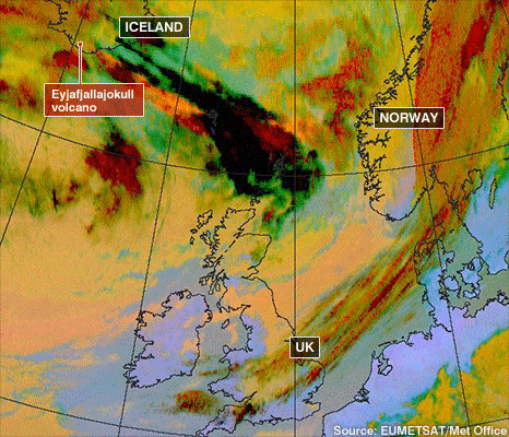
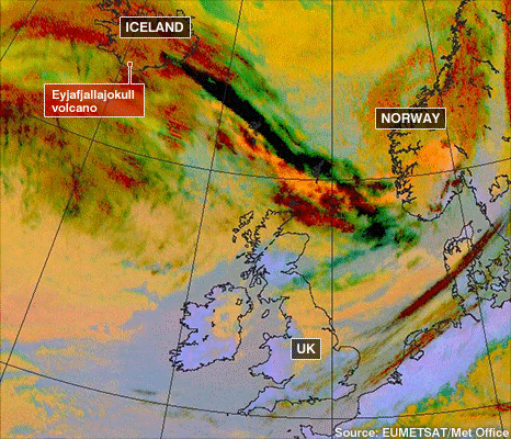
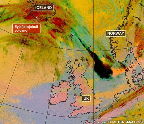
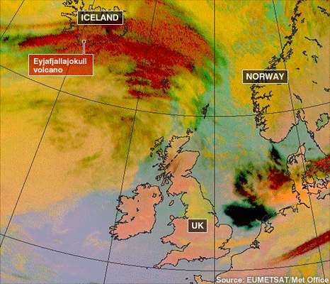
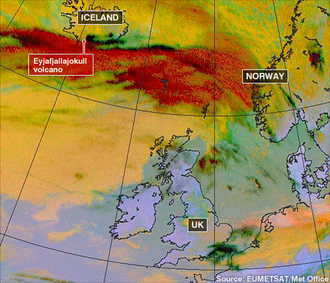
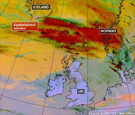
How the cloud spread
0930GMT 15 April
1530GMT 15 April
2130GMT 15 April
0330GMT 16 April
0930GMT 16 April
1530GMT 16 April
The satellite maps above show how the ash cloud spread over the first couple of days after the eruption. The black and dark red colours indicate the passage of the ash cloud, where the density of particles in the atmosphere is greatest. More satellite images of the eruption and cloud can be seen here .
Scientists now believe the worst of the ash cloud has passed - but geologists say the volcano could resume erupting at any time. The end of an eruption is officially declared only three months after the last seismic activity.


Bookmark with:
What are these?