----------------- -----------------  |  | | Last Updated: Wednesday, 4 April 2007, 12:14 GMT 13:14 UK |
At a glance: Walrus tracking | | Danish scientists are setting out on an expedition to tag walruses and track where the beasts migrate. The satellite data will be shared with BBC News and posted on its website so that readers can follow the migration. WHY TRACK WALRUSES? - Walruses play an important role in Arctic ecosystems, feeding on clams and other molluscs which live on the sea bed
 Walruses play a key role in Arctic ecosystems |
- They are thought to be at the top level of the food chain; polar bears are thought to sometimes attack them, but rarely score a kill
- Scientists want to better understand where the huge mammals migrate to; walruses have been difficult to study in the past because of the cold, remote places in which they live
- The giant beasts will soon begin a migration north to colder climes. But the exact location of their summer hideaway has long been a mystery
WHAT ELSE WILL THEY FIND OUT? - Like other Arctic animals, such as the polar bear, walruses are threatened by climate change
- Rising temperatures will cause all Arctic summer ice to disappear within about 60 years, according to predictions. The project aims to shed light on how this will affect the animals
| BBC NEWS - WALRUS WATCH Up to 10 walruses to be tagged Location data fed to Denmark BBC News to map positions |
- They are hunted by indigenous populations. Though graceful and swift in the water, their lumbering gait on land makes them an easy kill
- Researchers want to learn whether the animals are being over-exploited by hunting, and whether this poses a risk to the survival of some populations
- The animals feast on molluscs which live on the sea bed, but some of these vital feeding banks are in areas that are of interest to the oil industry
- The project will help identify whether oil exploration is affecting the walruses' feeding patterns
HOW WILL THE PROJECT WORK? - The tagging study is being run by the Greenland Institute of Natural Resources, in cooperation with the Danish National Environmental Research Institute and the Technical University of Denmark.
- A researcher team will set out on a boat from the Arctic port of Sisimiut on Greenland
- During two weeks at sea, it hopes to attach satellite tags to 10 walruses
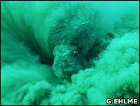
| See stunning underwater images of the tusked beasts 
|
- Data from the satellite tracking will appear on the BBC News website in a couple of weeks
- It will appear on a map, linked to from our stories, showing the animals' day-to-day progress during the two-month project
- The tags will be fired into the walruses' 2-4cm (0.8-1.3in) thick hide using a crossbow or CO2-powered gun
- Each time the tagged creatures emerge from the water, radio signals will be beamed up to a satellite, allowing the animals' coordinates to be determined
- The project is using the Argos environmental data relay system. Its satellites determine positions by monitoring the way the timing of reception and frequency of the radio signals "shift" as the spacecraft speed overhead
- After about two months, the tags will fall out as the walruses' hides heal
It is not clear whether the Laptev walrus is a separate subspecies |
| | SEE ALSO
RELATED INTERNET LINKS The BBC is not responsible for the content of external internet sites
| |
|