28 October 2014 |

| |
BBC Homepage | |||
Contact Us | |||
FeaturesYou are in: Kent > Thames Gateway > Features > Rochester Riverside masterplan 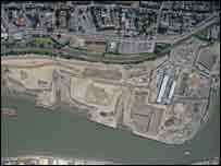 Rochester Riverside: aerial shot Rochester Riverside masterplanRochester Riverside is being cleared, cleansed and flood-proofed for the creation of a new waterfront community of 2,000 homes, a hotel, school, medical facilities, shops, restaurants, pubs and cafes. Images of the future show how the Rochester Riverside regeneration site is expected to look. 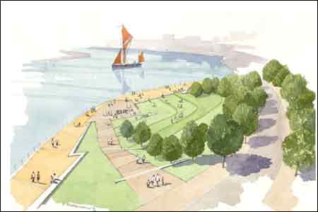 Rochester: Crescent Park They reveal the vision for public open space on the riverfront and across 2 7hectares (66 acres) of prime development land. Key artist’s impressions (attached) show St Clement’s Park, Crescent Park and a section of the proposed River Walk. 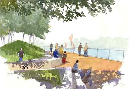 Rochester: River Walk Founder, Diana Armstrong Bell said, "The new landscape uses crisp earth embankments mass-planted with drifts of native ornamental grasses in memory of the former grazing marshland. Hard materials derive from those found on the site – chunky timber, steel, gravel and glass the colour of a sea-washed bottle. “The landscape is designed to connect new neighbourhoods with the river by leading pedestrians between buildings to sheltered spaces on the River Walk.” 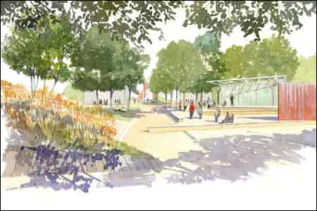 Rochester: St Clement's Park The 50-page masterplan was commissioned by the site’s joint owners – Medway Council and SEEDA, the South East England Development Agency. Riverside VideoVideo: Brian Weddell, the Chief Executive of Medway Renaissance [Medway Council's Thames Gateway delivery arm], describes how work is coming at the Rochester Riverside site: Help playing audio/video The watercolour images are taken from the Landscape and Open Space Masterplan for the site, produced by Armstrong Bell. last updated: 05/06/2008 at 14:27 SEE ALSOYou are in: Kent > Thames Gateway > Features > Rochester Riverside masterplan |
About the BBC | Help | Terms of Use | Privacy & Cookies Policy |