
Post tropical storm Roke moves North East
Post categories: northern hemisphere, storms, your pictures
 |16:00 UK time, Thursday, 22 September 2011
Distance travelled ~ 680'934'400 km
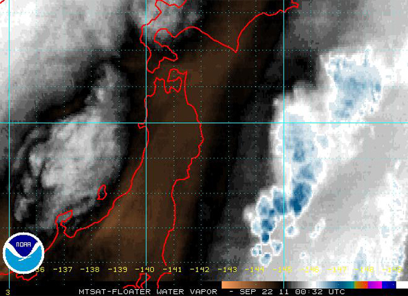
Radar image showing water vapour near Japan as Post tropical storm Roke moves North East into the Pacific. Great loop image showing the movement of Roke 21/22 september. https://www.ssd.noaa.gov/mtsat/flt/t2/loop-wv.html
Although Typhoon Roke was a smaller storm than Talas (which hit Japan early September), it was stronger in terms of wind strength. When Roke made landfall in the south coast of Japan, in Hamamatsu 14.00 JST 21 September, it reached speeds of 90kts ( 100 mph). Over the period of 48hours prior to Roke making landfall it dropped over 575 mm of rain in Tokushima. Japan received an average of over 400mm of rain, including Tokyo. Roke is currently moving NE at 45km/h.
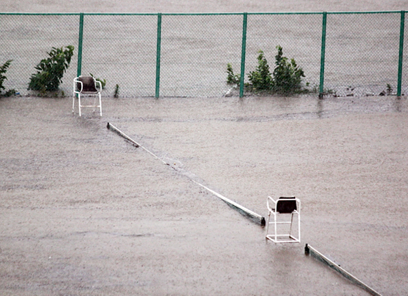
Image captured by A.Wainwright
Image captured by A.Wainwright, Japan. "It was taken from my 4th floor balcony overlooking the tennis courts outside my apartment in Kawasaki City, Greater Tokyo during typhoon Roke, 21st. Sept. 2011"

Image captured by Aaron Robotham

Image captured by Aaron Robotham
The above photos captured by Dr Aaron S.G. Robotham of St. Andrew's University. The top image was taken "outside Shibuya station during our long walk home." The second image was outside Ebisu station in the taxi queue. We queued for a taxi for 1-1/2 hours but eventually gave up and decided to walk back to our hotel. We gave up using the umbrellas since they were just getting blown apart and we couldn't get any wetter."
More on this story: Typhoon Roke in pictures
 Kate Humble:
 Helen Czerski:
 Stephen Marsh:
 Aira Idris:

Comments Post your comment