
Day 256: This week's severe weather watch
Distance travelled ~ 657'404'000 km
Remnants of Katia hit UK but warnings now cancelled:
• In the UK, the gales and heavy rain resulting from the deep area of low pressure which contained post-tropical storm Katia will slowly ease across northern parts and a couple of fine, quiet days can be expected later in the week.
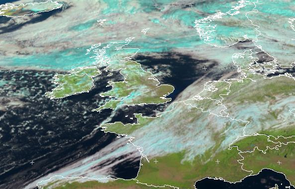
Image courtesy EUMETSAT. Latest satellite imagery. Central Europe. MET9 RGB-3-3-1 2011-09-13 10.00 UTC
• Northwestern Europe will also be very unsettled as the low pressure area moves across Scandinavia. Some areas can expect to have unusually strong winds with southern Scandinavia, Denmark and far north of Germany most at risk of severe gale/storm force winds.
Tropical storm watch for Bermuda whilst Nate dissipates:
• Tropical Storm Maria is expected to move towards the Bahamas during the first half of the week before turning northeast and heading out over the open waters of the Atlantic.
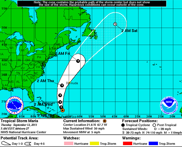
Image courtesy of National Hurricane Center/NOAA. The Bermuda weather service has issued a Tropical storm watch for Bermuda. Maria is moving toward the North-NorthWest near 5 mph.
• Meanwhile Tropical Storm Nate has dissipated over Mexico but will continue to give heavy rains for a time.
Possible tropical formations:
• There is the risk of further tropical cyclone formation later in the week to the northeast of Taiwan and southwest of Japan.
• Potential for tropical storm formation in Arabian Sea with heavy rainfall risk adjacent land areas of Pakistan.
 Kate Humble:
 Helen Czerski:
 Stephen Marsh:
 Aira Idris:

Comments Post your comment