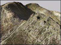
A view of Mount Snowdon in Gwynedd on the new 3D map 
|
A new map has been published which claims to gives the most accurate image yet of the landscape of England and Wales. It is the first complete three dimensional internet map of the two countries.
The map will make it easier to predict which areas are most prone to flooding, subsidence and coastal erosion.
The data was collected by bouncing a radar from a Lear jet, mapping every five metres with a height accuracy of 50cm.
 |  In a very short time frame, the entire country has been captured in one frame of imagery In a very short time frame, the entire country has been captured in one frame of imagery  |
A total of eight billion individual measurements were taken for the project developed by Intermap Technologies.
The Environment Agency, which has responsibility for flood defence, risks and flood awareness, welcomed the map's publication.
Spokesman Doug Kempster said: "This new 3D map is very good when looking at England and Wales as a whole.
"It will be used as a component in our ongoing flood mapping project".
Flood costs
Norwich Union will be using the technology to adjust premiums based on flood risks.
Spokesman David Ross said: "The last round of big floods about two years ago cost the insurance industry �1bn".
He said the average household claim for flood damage was �15,000 and �30,000 for a business.
 A view of Beddgelert, Gywnedd, if it flooded |
"We predict that 20% of properties will be taken out of the 'flood risk' areas. This is all cutting edge stuff."
Hugh MacKay, of Intermap Technologies, said the map could also be used to help decide on the location of telecom broadcast towers and to assess land around airports for runway development.
"In a very short time frame, the entire country has been captured in one frame of imagery.
"The information has been collected in one period of time, rather than the traditional sources of mapping which have taken many decades to compile", he told the BBC.